Hi folks! I had the pleasure of hiking a stretch of the ECT that is under development this weekend, from Cape St. Francis to Bauline. Out of respect for the ECTA who will be releasing the map and trail description later this year, I’ll wait until that time to describe the trail. For now, I’ll give a quick description, instead, of my experience, and share some pics of the spectacular views. Let me stress: this is a strenuous and challenging hike in many respects, including confusing areas where hikers could potentially lose their way. The vast majority of hikers should wait for the map and trail description before attempting this path.
I saw a 24 hour window with no rain and so I went for it. Driving towards Bauline, the rain let up and the clouds broke as predicted. So far so good! I had a good friend pick me up in Bauline and drop me in Pouch Cove so I could hike back to my car. I couldn’t ask her to drop me at the trailhead in Cape St. Francis because the road is pretty rough so I hiked in from the town and took the old path described in my last post, skipping the first big climb, the starrigans, and the rope-assisted climbs on the Cripple Cove section of the trail.
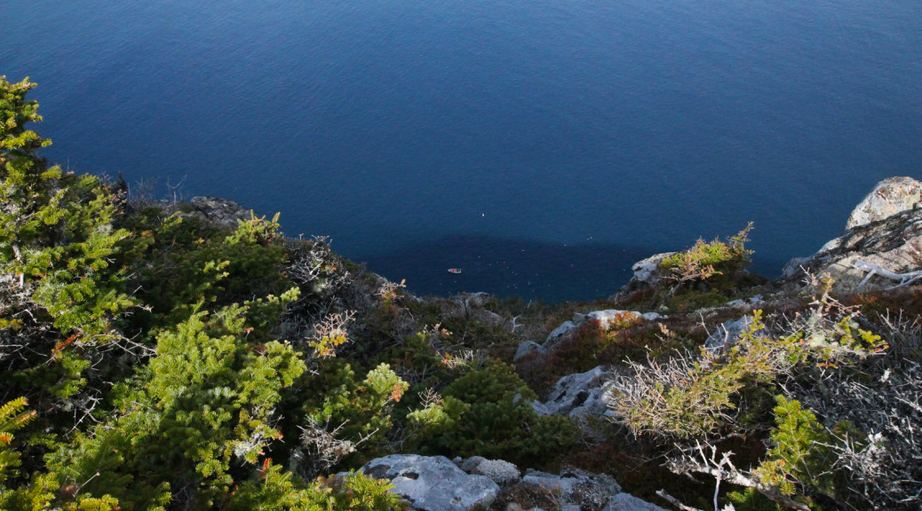
Anyhow, as I said, no trail description, just my impressions: this is a hike unlike any other on the East Coast Trail. The landscape here is very different: crossing hilltops high above the ocean, with most places a 70 degree slope to the ocean below, in some, completely vertical. Much of the hike is spent at an extremely high altitude. The views are spectacular and hard to compare to any other leg of the trail.
I had acquired a map of the area and was pretty confident that I’d be able to end my first day at a place called Trout Pond. I brought my rod, thinking this was a sign. Arriving at Trout Pond as predicted, the sun was setting and it was getting COLD. No trouting for me. I set up my tent and got into my sleeping bag as quickly as I could, and spent a night struggling to get sleep in the -1C temps and wind. At some point during the night the wind died down and I got a few solid hours. The next morning I debated starting the day with a trouting session but I decided to just fire through the trail and reward myself with some take-out instead 🙂
Fine weather, spectacular views, and a moose having a munch in mid-trail, the second day was as good as the first. I arrived in Bauline well ahead of schedule and made my way to Swiss Chalet for some well-deserved ribs and wings.
Here are a few pics: many more to follow when the ECTA officially opens the trail!


Hi Gerry
Have you done Bauline to Portugal Cove yet? It’s my last section and I’m about to try it if the weather co-operates… but my ECTA draft map has no distance info.
Randy