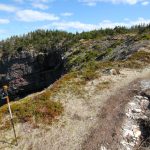
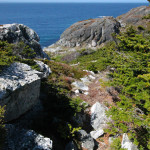
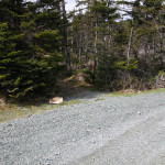
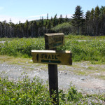
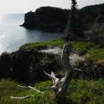
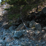
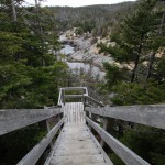
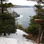
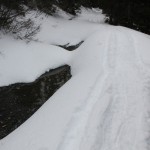
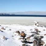
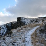
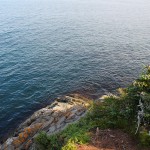
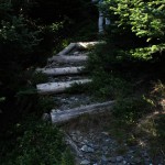
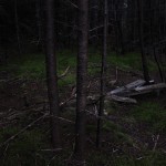
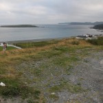
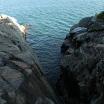
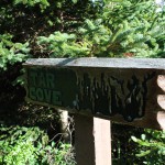
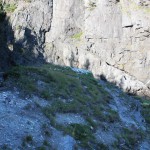
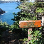
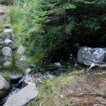
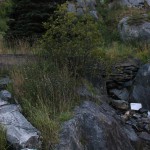
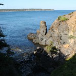
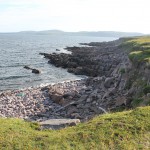
Heather’s least favorite part of the Tinkers Point path. Mine is the south trailhead, just past this point, which some neighborhood dog seems to be using as a toilet.
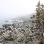
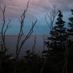
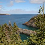
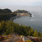
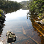
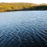
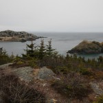
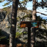
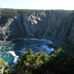
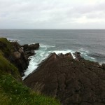
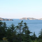
My perennial shot of Tinkers Point, shrouded in fog, the beautiful colors of the spring foliage.
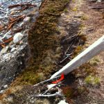
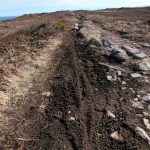
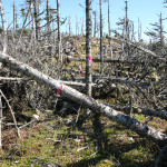
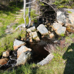
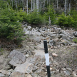
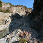
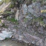
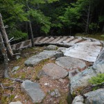
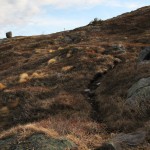
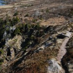
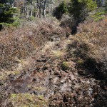
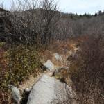
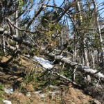
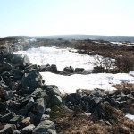
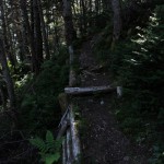
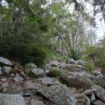
A reroute of a section of trail due to erosion. This has been a problem for many parts of the ECT, but this was certainly a spot in need of remediation.
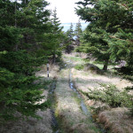
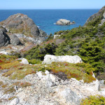
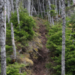
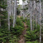
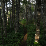
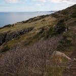
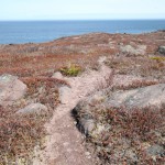
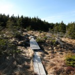
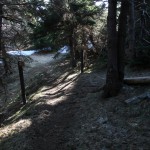
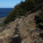
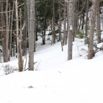
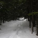
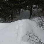
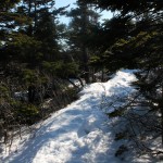
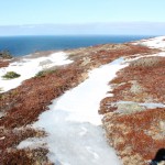
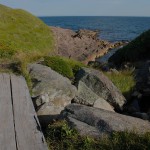
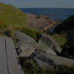
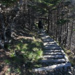
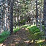
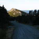
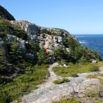
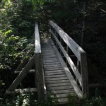
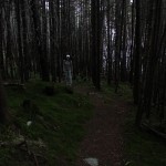
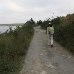
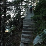
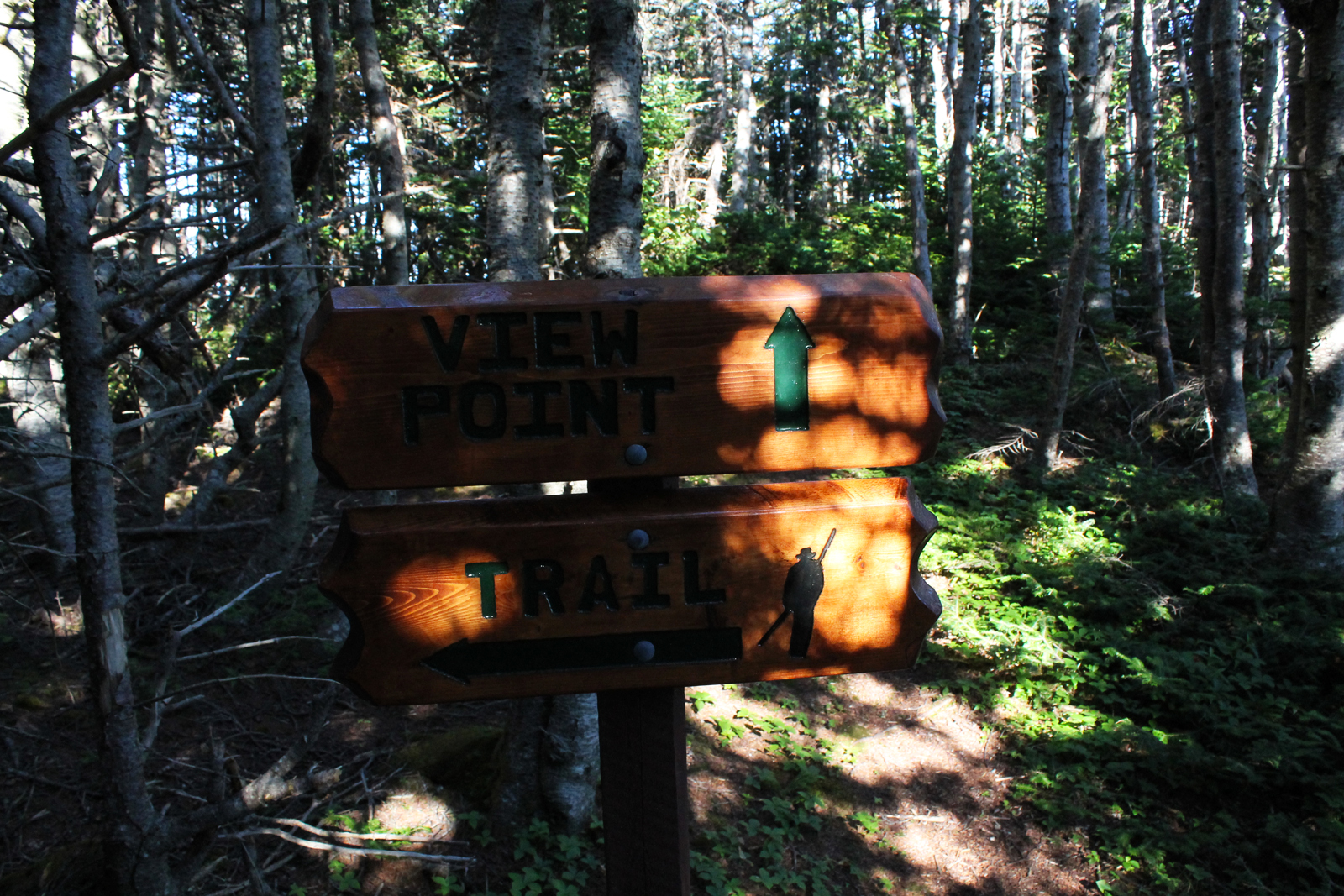
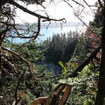
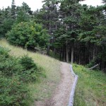
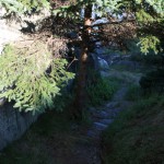
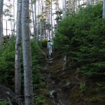
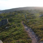
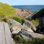
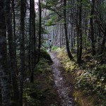
The trail leading toward Tinkers Point.
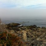
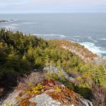
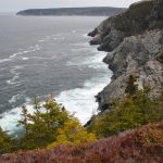
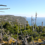
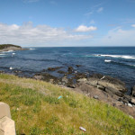
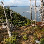
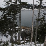
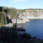
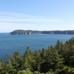
A foggy day on the trail, with the view south from Cape Canine telling the tale!
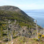
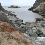
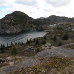
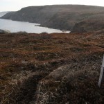
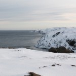
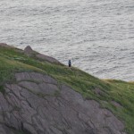
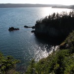
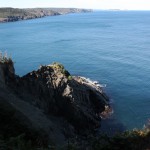
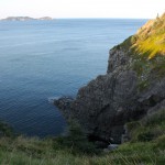
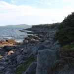
A final look back towards Motion Head from above Siles Cove.
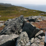
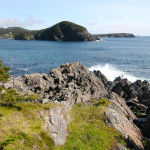
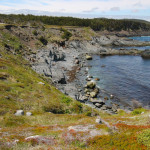
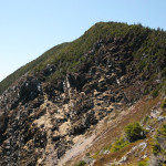
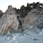
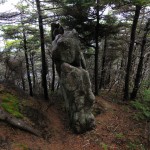
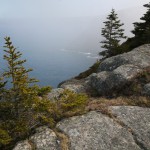
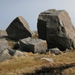
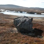
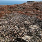
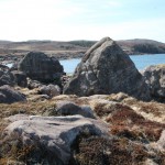
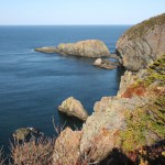
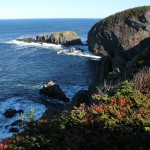
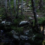
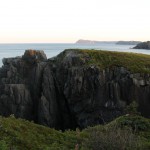
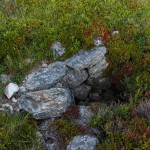
Erratics are one of the main attractions on this trail, with these hoodoo-like rocks to the left on the approach to Motion Head.
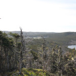
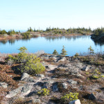
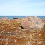
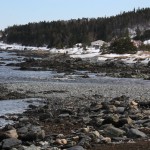
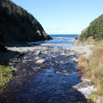
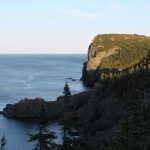
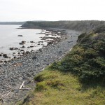
Lower Cove Pond in the distance as we descend from Burke’s Head.
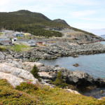
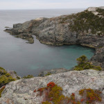
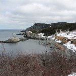
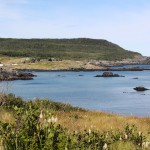
Harte’s Point Cove.
We started up the Tolt the next day.
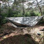
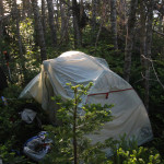
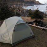
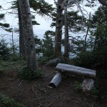
Andy had a bit of a tighter squeeze for his hang, but he made do. Evan had a great spot for his tent.
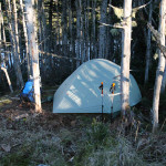
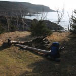
My hammock was in a great spot!
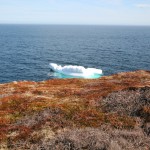
As we cooked our suppers, the sun set behind us, and the sky to the east turned an incredible shade of blue. I tried to capture it on camera but it didn’t quite happen. Notice the iceberg on the horizon.
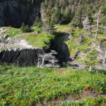
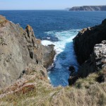
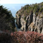
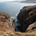
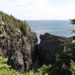
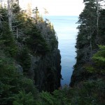
A steep-sided gulch along the trail.
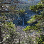
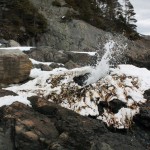
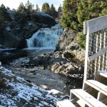
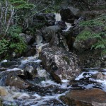
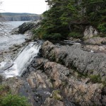
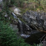
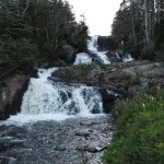
The twin falls at Raymond’s Gulch are very pretty. A stray buoy sat at the bottom of one of the cascades and made a sound like a drum as the water hit it.
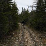
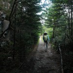
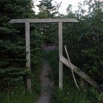
Off we go!
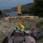
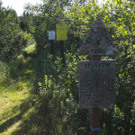
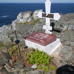
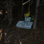
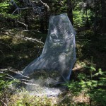
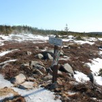
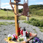
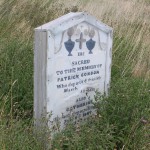
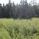
At the field just past the trailhead, a memorial had been placed since the last time I was here. I can understand why someone would want to be memorialized in such a beautiful place.
We started in over Shoal Bay Road as the sky clouded over.
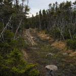
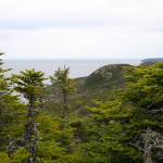
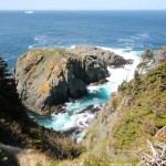
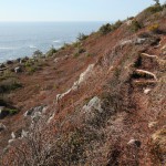
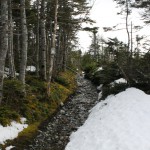
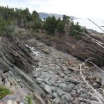
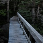
Some more spectacular trail.
Waterfall in one of the coves.
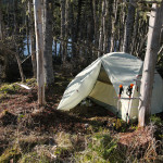
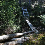
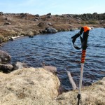
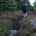
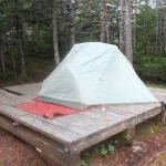
Successfully hung hammock! Looking forward to lashing the rain fly in place and spending a night!
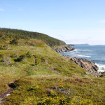
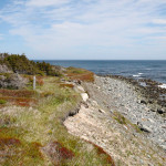
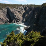
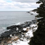
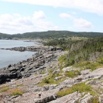
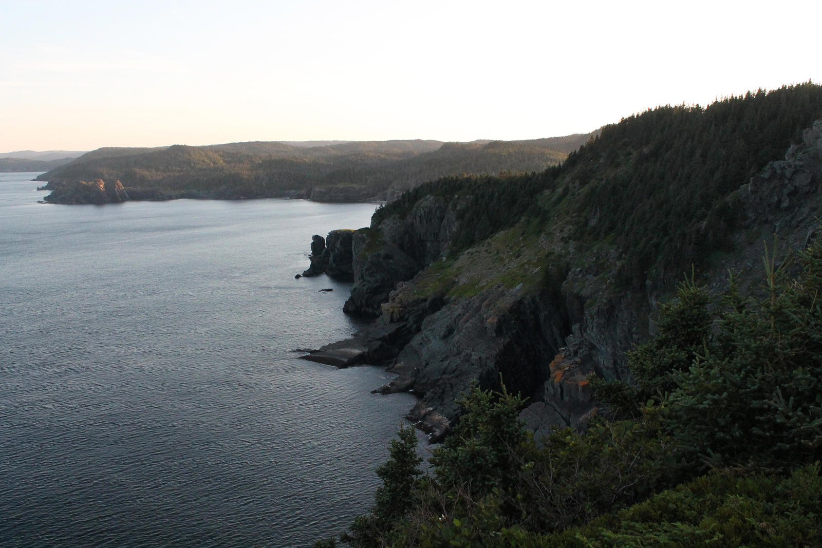
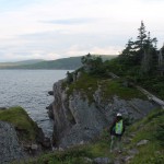
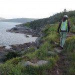
This trail is at its best when rounding the gulches and coves.
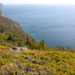
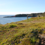
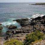
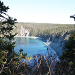
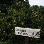
Island Cove on the bright, sunny day, clear water below.
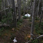
More pics of the pretty trail.
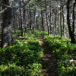
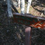
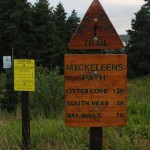
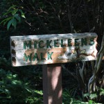
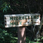
A beautiful day in the woods along Mickeleen’s Walk.
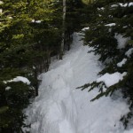
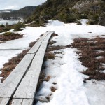
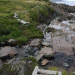
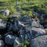
A fair bit of extra water on the trail!
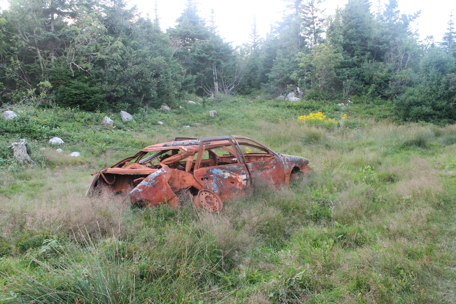
An attempt at recapturing the cover image.
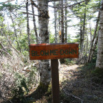
Some trail damage at Breaking Point.
A massive flock of birds (turrs/Common Murre?) that stretched into the fog.
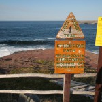
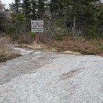
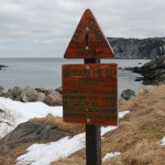
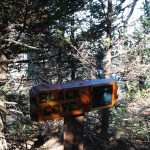
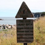
Good advice for dog-walking hikers in any situation, but especially here!
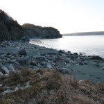
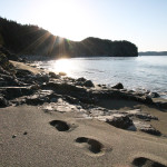
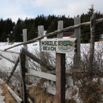
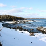
A foggy day made the beach in Mobile spooky but very pretty!
Returning to beautiful Pouch Cove.
Shoe Cove with the moose clearly visible on the left hand side of the picture.
The remains of a small moose at Shoe Cove.
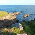
Beautiful, clear water.
The destruction a couple of kilometers in actually crosses the trail. Again, it’s time we protect the coastline and the trail the way the Appalachian Trail is protected.
Shoe Cove Island in the distance.
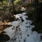
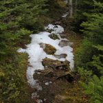
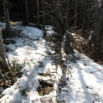
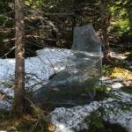
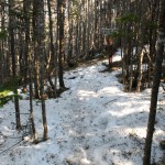
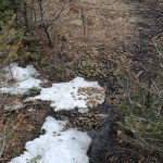
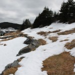
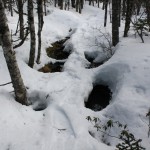
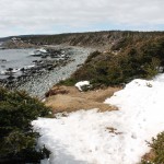
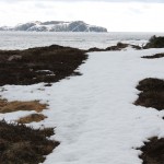
Still some patchy snow from the most recent storm. Likely melted at this point.
A flock of starlings in Pouch Cove. Beautful, big blue skies.
Maybe a rock wall? I know I’m reaching.
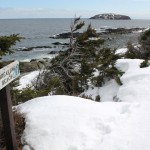
A look down from North Head reveals snow in a sheltered nook.
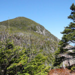
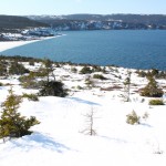
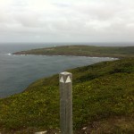
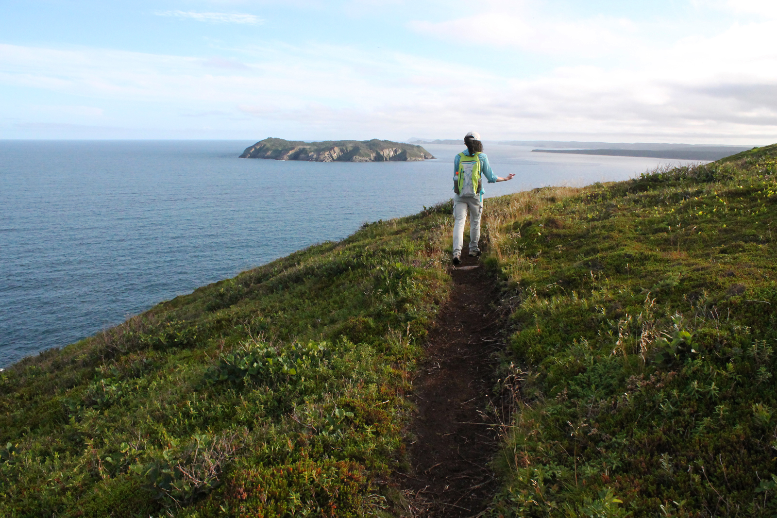
Here’s North Head, finally!
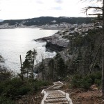
Here’s a look down at Summerside from the North Head side trail… you can see the boardwalks of the ECT as it approaches the area (and a few dots that are hikers heading up out of Summerside).
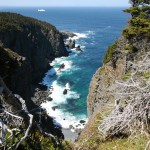
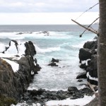
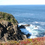
The rough seas made for spectacular views south of Cape Spear.
Bike tracks on the treadway.
On the way back out over the Cape St. Francis road, we noticed this phenomenon in a marshy patch alongside the road. Not sure how visible it is, but there is a steam/fog rising from the water, most visible in the top left of the picture. Pretty crazy… right mix of temperatures and sunlight is my guess, evaporation and quick condensation!
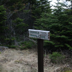
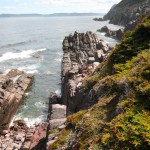
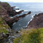
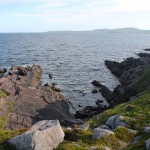
Cripple Cove rocks up close.
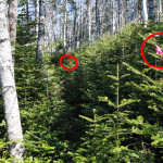
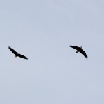
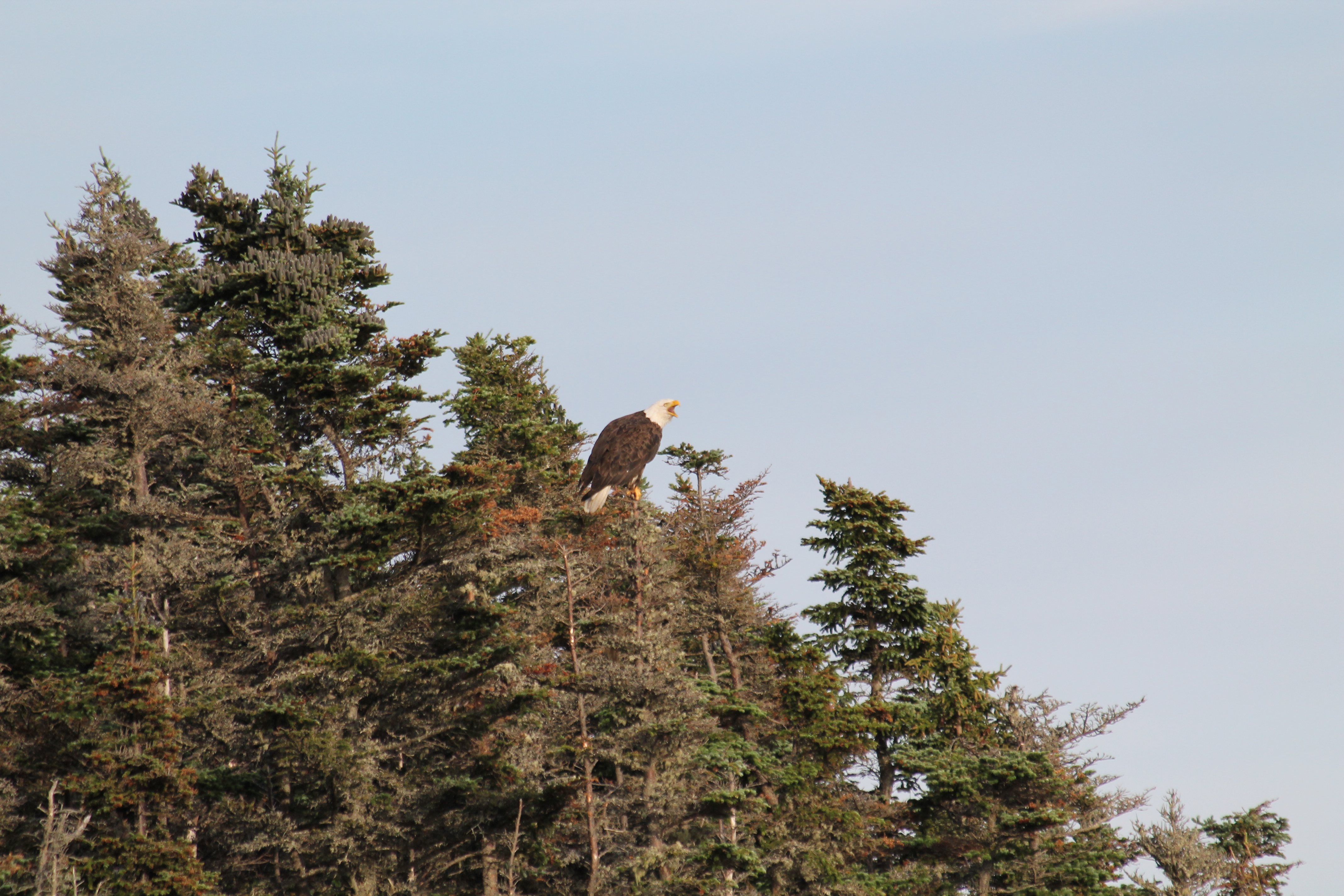
Circled is the eagle. Not a great pic but he was a ways away.
Looking down towards Cripple Cove from high above Big Cove. Marked is the location of the perched eagle in the next picture… I suspect this is the location of a nest.
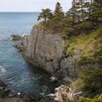
This rock formation that the trail climbs past is fascinating to me.
The first view of the Cripple Cove rocks from the east end of Big Cove.
The starrigan field just past the rope-assisted climb. I’m not sure of Heather agreed it was worth it, but she enjoyed seeing them!
Back Cove at the start of the White Horse Path, with Cape St. Francis on the east side.
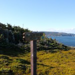
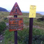
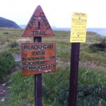
The trailhead, with Blackhead and the rest of the ECT extending beyond it!
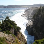
Heavy seas in the gulches at trail’s end!
Coming down the south side of Blackhead, some snow still on the trail.
The view of Cape Spear from atop Blackhead.
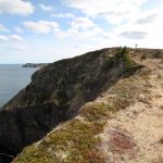
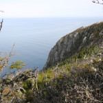
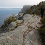
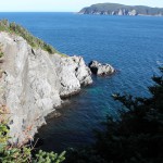
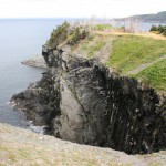
The only “cliffy” section: it’s hard to capture the height on camera.
A rock wall blocks the former trail. My guess as to why this was done is that the fence is constructed to the actual edge of the property. I’m not interested in violating private property rights but I think this stretch of shoreline should never have been allowed to be sold.
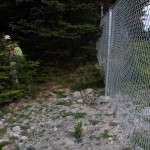
A tunnel of fences keeps hikers on the trail.
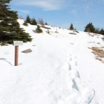
There is still a bit of snow on the new woods section.
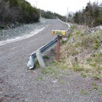
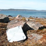
The new trailhead. mind the glass and garbage.
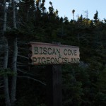
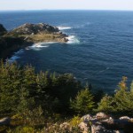
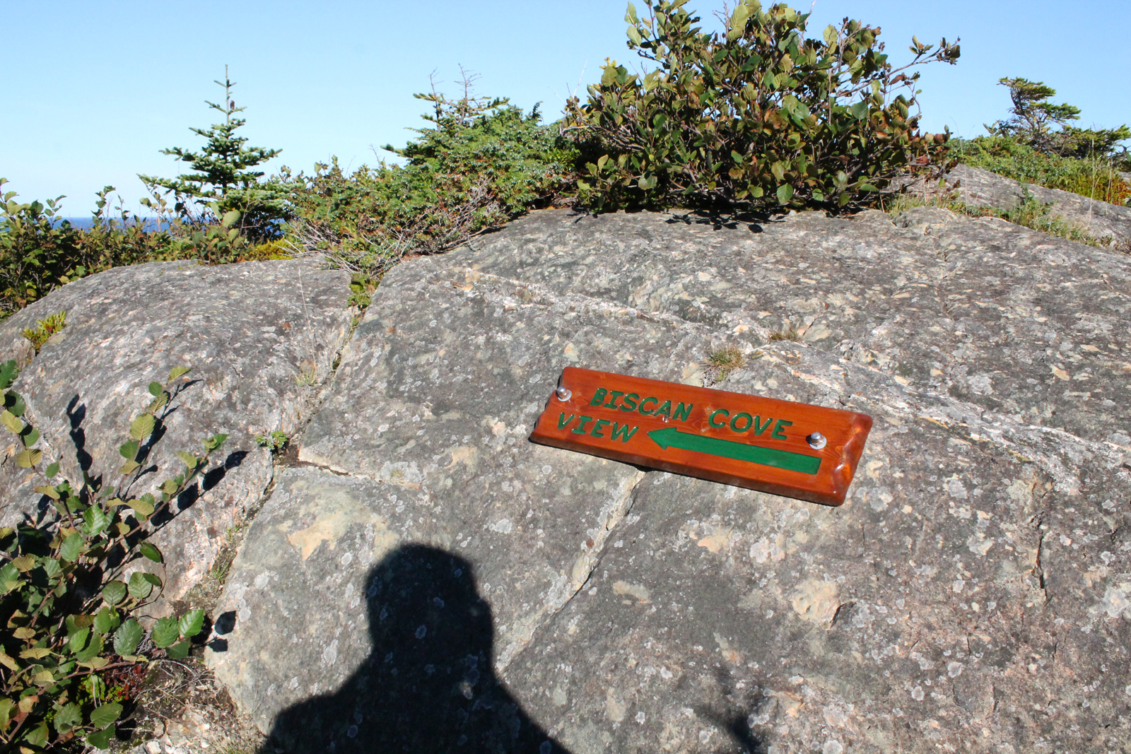
Looking down towards Biscan Cove before descending towards it.
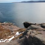
This is all the snow/ice left on the trail as of the 2nd week of April! Not bad.
The gulch past White Point is another spot that never disappoints.
The sun came out as I approached the aptly named White Point.
Here is the unmarked branch pictured above. Hikers should keep left (both because that’s the continuation of the trail and because heading right will be disappointing).
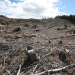
Looking back at the cutaway it is clear how much destruction has taken place.
The cutaway at the new branch, Pretty sad. Someone cleared more than an acre… much more than is needed for a cabin.
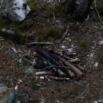
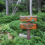
I was disappointed to see this on either side of Freshwater River. The firepits couldn’t have been more than 50 feet from one another. If you’re going to violate the prohibition on open fires along the trail, at least reuse established pits instead of creating new ones, folks. As users of the outdoors we need to learn to Leave No Trace.
The side trail at Freshwater River always makes for spectacular views.
Parts of the trail are starting to get a little tight! A first for me on this trail.
The seas are looking rough despite the wind being nonexistent on this gray day.
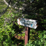
Horse Gulch is always a spectacular sight at the start of the trail heading north.
Our final destination!
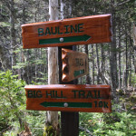
Rounding the corner into beautiful Bauline.
Some community use on the trail close to Bauline.
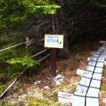
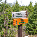
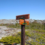
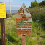
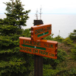
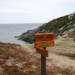
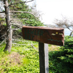
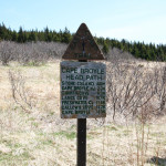
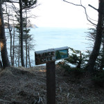
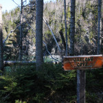
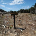
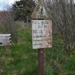
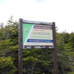
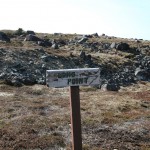
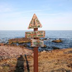
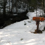
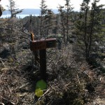
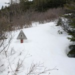
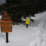
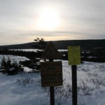
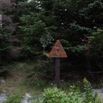
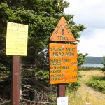
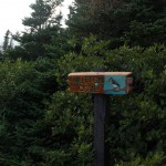
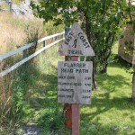
Signage has been here for a while, it seems.
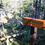
Pincombe’s Brook on the approach to Bauline.
After climbing some big hills earlier, I skipped Big Hill on the side trail close to Bauline.
The first view of Bauline below.
Bell Island is visible clearly from this point.
Looking down at Crow Head Pond.
Another hard scramble!
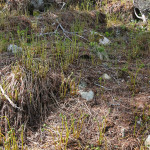
Lots of fiddleheads!
Looking back after passing the Park.
The view from the western end of the Park.
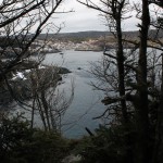
Another view of Little Herring Cove Pond.
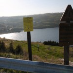
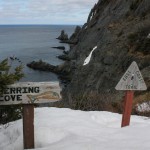
Little Herring Cove Pond at the Park entrance.
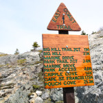
Signage at the Park entrance.
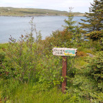
The trail markings for the side trail to Marine Drive Provincial Park.
South from that point.
The camp and playground area at Marine Drive Provincial Park.
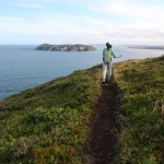
The scenery from up here is pretty incredible!
Some more perspective… A fisherman WAY below us!
A look back at some of the scenery behind us.
Some more steep scrambles.
Fiddleheads were everywhere. I’d still like to try frying some up.
The sun is bright looking south!
Getting started at Trout Pond the next day!
Scenic Trout Pond. I decided against trouting and decided to stay warm.
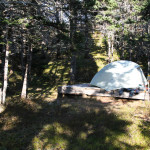
Camp at Trout Pond!
Just past the sign and across a small river, another significant climb.
The boundary of the Marine Drive Provincial Park.
About to make a downward climb.
Looking way down!
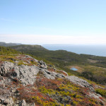
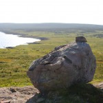
Some hilltop erratics.
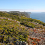
The beautiful view of Conception Bay stretching out to the south as we walk high above it.
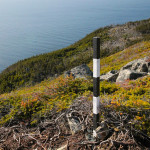
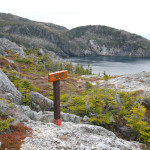
The aforementioned trail marker with the clearing below.
A look alongside the trail gives some perspective as to the steepness of the hill.
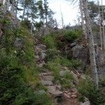
A steep scramble in spots.
Interesting erratic on the climb!
The trailmarker is visible well above us.
A clear section before a major climb.
Pay close attention to blazes in these confusing sections!
Signs of moose are plentiful along the trail.
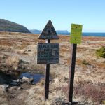
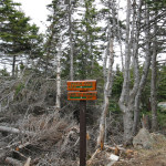
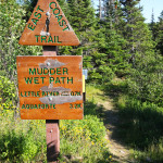
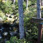
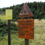
Some signage at major points of interest including Patch Brook.
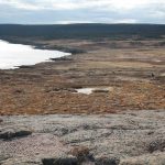
Back out into the barrens.
The trail is on the other side of this mudhole.
Bug kill along the trail. Careful in these sections as it is easy to go astray.
The trail extends into the distance.
There were wide swaths of tree kill along this trail. A few moose paths and a section are visible on a flat section below the trail.
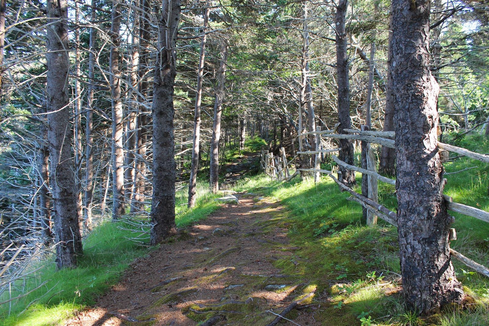
A beautiful section of trail through tree cover.
The elevation is massive here. It’s hard to translate the perspective to a picture.
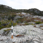
This section of trail is well-marked, atop the Scrape.
Signs in some key spots to keep hikers from taking branches.
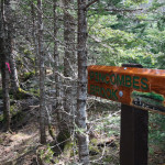
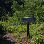
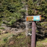
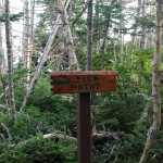
Trail signage.
A look down at some signage below.
The trail south across the barren hilltop.
The ECT put in work placing these trail markers!
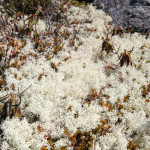
This white lichen was plentiful.
One more look at Cripple Cove far below!
The walk atop the Scrape is very barren!
Another look down at Cripple Cove from an even greater elevation.
The trail is a little steep and rough in spots.
Looking back down towards Cripple Cove, far below.
The steep climb up to the Scrape.
Heading back, the branch at the Cripple Cove side trail.
Cripple Cove is a beautiful spot!
The view of Cripple Cove from the signage.
Climb around the rock on the right side to get down to Cripple Cove.
Climbing down to Cripple Cove.
Looking forward to the trail above the Scrape and on to Bauline.
White rocks as the trail opens up above Cripple Cove.
The trail along the peak above Big Cove North.
The Cripple Cove Rocks visible from the western end of Big Cove North.
An erratic along the path in the Cripple Cove section.
The intersection of the old and new sections of trail. From here towards Cripple Cove.
I started from the old entrance, skipping the first section that I had hiked a couple of days previous.
And with that, the East Coast Trail is complete!
Making his way back to momma!
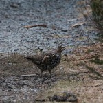
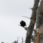
My little grouse friend… he was stuck here so I helped him out.
More rock walls.
The signs of former settlement at Blacksmith.
A look at North Head from near Water Cove.
Fanny’s Cove Meadow.
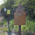
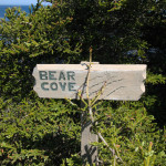
Looking back at Bear Cove Point.
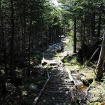
Much of the remainder of the trail is a beautiful woods path.
Bear Cove Point and Little North Cove
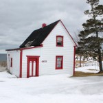
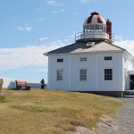
The residence with the lighthouse behind.
The site of the lighthouse at Bear Cove Point.
Crossing Bear Cove River.
The side trail to a viewpoint on South Point is worth exploring. Looking back at Southern Cove.
South Point.
Not sure which landform this is (Manny’s Gulch maybe?) but it’s distinctive… a large, flat section of rock.
The next morning, the rocky coast was spectacular at the Klondike River crossing.
Tucked uncomfortably into the trees past a small stream.
Sculpin Bay was my intended location for a camp, but there doesn’t seem to be a good spot here!
Ships Bottom, a flat section of rock.
The meadows outside Renews are beautiful.
Aggie Dinn’s Cove just past the trailhead.
At the end of some narrow, winding roads, one finds the Bear Cove Point Path trailhead!
The tourist stop in Renews.
Another trailhead greeter!
At the trailhead, on into Renews!
Calves Cove near the trailhead.
Looking towards Renews.
Mostly a woods trail at this point, one of the breaks in the trees reveals beautiful coast.
Looking back towards Gripe’s Nest.
From atop Gripe’s Nest to the next section of trail.
One significant climb over Gripe’s Nest Hill.
The trail rounds a couple of gulches on the northern end, including this one at Peter Power’s Cove.
Island Meadow.
The trail’s namesake, Island Meadow.
Renews Island.
This is what a large chunk of this trail looks like.
Bear Cove.
From the tourist stop at Bear Cove.
The trail heads around private property up onto the road.
Beautiful butterfies greeted me at various spots.
Round Cove.
Round Cove.
Some fiddleheads are still appearing!
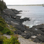
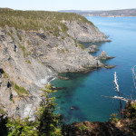
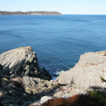
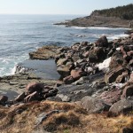
Beautiful rocky coastline.
In here, things start to get a bit wet.
The trail enters the woods just past Middle Cove.
Burnt Cove.
Just outside Cappahayden.
The trail heads out of Cappahayden along the meadows at the ocean’s side.
More from beautiful Cappahayden.
Beautiful Cappahayden.
Beginning the final hike!
A greeter at the southern trailhead in Cappahayden.
The trailhead in Bauline.
Scenic Bauline.
A look back at the beautiful landscape recently hiked.
A hill approaching Bauline, Bell Island visible in the distance.
Perhaps the best picture I took for height perspective… a fisherman straight down from the side of the trail.
Looking back on one of the hills we climb.
The sun sets on Trout Pond.
I found a spot amongst the dead trees with Trout Pond behind me!
Just spectacular views from this high up as the coast continues south along Conception Bay.
The elevation change and beautiful landscape ahead.
Hard to get the perspective on camera, but we’re high in the sky at this point.
High atop the hills, the forms of life are pretty fascinating: there were masses of this lichen.
Well above Cripple Cove, a look back at the Barracks hill.
Cripple Cove is a spectacular spot.
The west end of Big Cove.
The Cape St. Francis lighthouse from the trailhead.
The second rope-assisted climb looks much crazier when observed from down here.
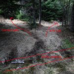
Again, some interesting but difficult to interpret evidence.
A closer look at the starrigans. Newfoundsander wondered on his blog what happened here… was this a natural death, a fire, insect kill? Hard to say. The blackened section on this small piece might be fire or it might be the signs of a disease.
It’s too bad the other, newer trail is so much better scenery-wise, because this woods trail is nice.
This nondescript turn is the location of this old trail.
Meeting the Cape St. Francis road, some additional signage.
Signage along the old trail.
The start of the old trail from the branch at the bottom of the Big Cove ridgeline.
Heading back, some interesting erratics.
The trail beyond Cripple Cove…
Lion Gulch on the back end of Cripple Cove.
The still waters of Cripple Cove were crystal clear.
South along the coast of Conception Bay from the Barracks.
North at Cripple Cove rock from the Barracks.
Looking east from the Barracks to Gull Rock.
The Barracks climb.
Beautiful Cripple Cove.
The geology is fascinating down here. Some kind of conglomerate? I wish I knew more.
Cripple Cove!
The branch to the Cripple Cove side trail.
The white rocks above Cripple Cove.
This crossing made for an interesting puzzle with logs placed randomly, some of which sink, some which don’t 🙂
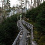
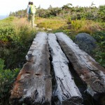
Old-school planks!
One of the few places where hikers might get (very temporarily) turned around.
The insect kill is visible as the trail heads down towards Cripple Cove.
Great signage!
At the bottom of the other side, the well-marked intersection with the old trail.
The Biscan Cove Path on the other side of the ridge.
The view from the ridge is spectacular.
Lots of steep sections appraoching the ridge over Big Cove.
The steep climb begins.
Some interesting stuff in the crevasse!
A short crevasse.
Heading up.
The view from the bottom of the hill heading around Big Cove. I saw a whale from here!
The trail heads into the woods for a bit.
Looking at Big Cove (North) from the starrigans.
The starrigans! Beautiful.
Looking back at Back Cove.
The view of the west side of Back Cove from the second rope.
The second rope-assisted climb is down over a bit of a scary spot. The pics don’t do it justice yet. That said, the pics also don’t do it justice in terms of how safe it actually is… it’s very wide and if you hug the rocks on the left you’re good.
This… doesn’t look good.
The view of Back Cove after the first climb.
The first rope-assisted climb! It’s not bad.
From Back Cove, the trail heads steeply uphill.
Back Cove. A bit of a hangout.
The trail is well cut!
The climb down to Back Cove.
Some perspective on where the trail initially goes, markers firmly placed in the rocks.
The first view of Back Cove.
The sign for hikers approaching from Bauline.
An official trailhead sign! Just before one gets to the gate of the Cape St. Francis lighthouse on the left.
I parked at Biscan Cove. Had t snap one here. Love this place.
Check out the frost growing sideways from the wood!
Peggy’s Leg.
Peggy’s Leg.
One of the jagged rocks visible from the trailside as it approaches the Blackhead end.
Looking north.
The river crossing is easier than it looks.
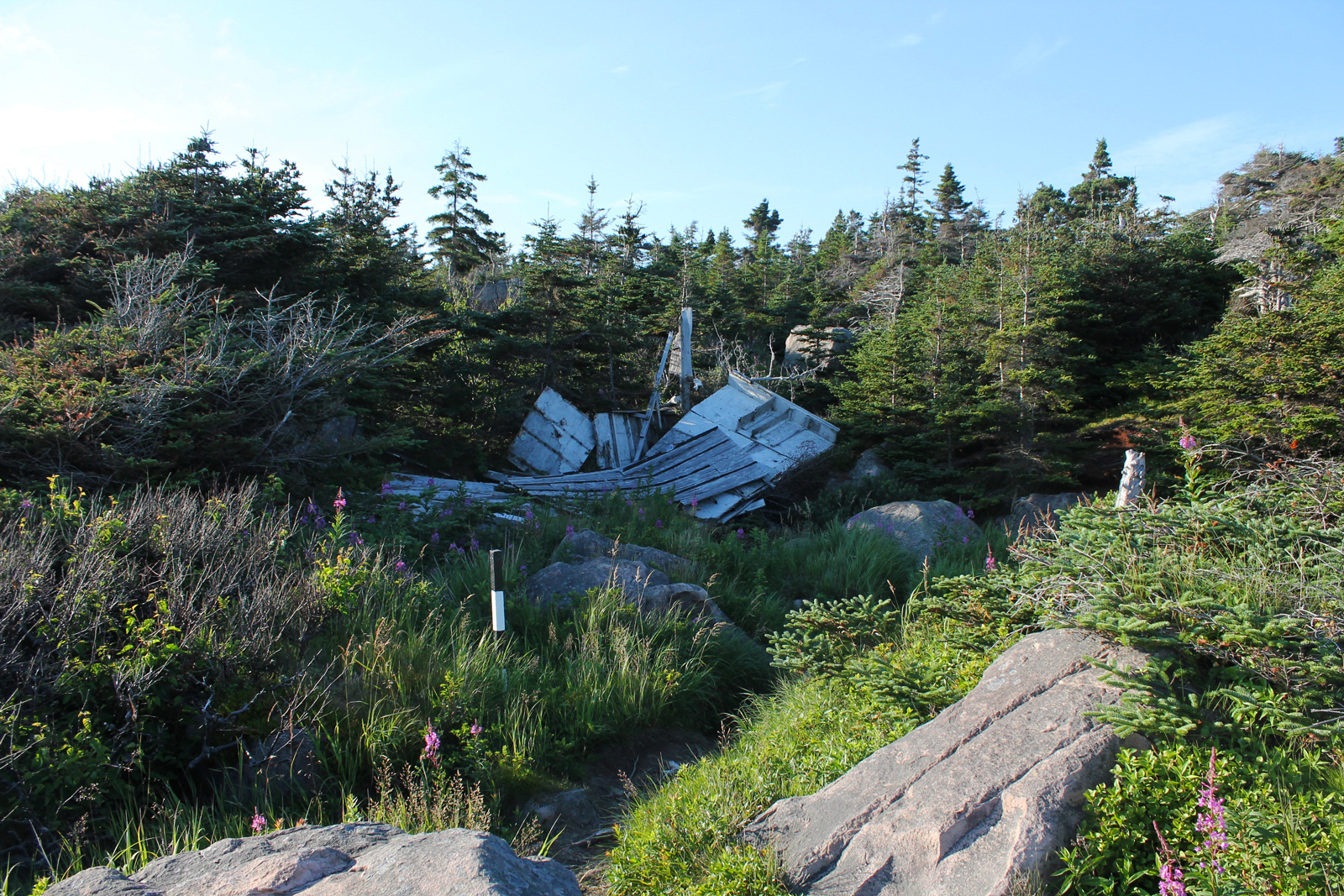
The wreckage of something.
The trail here consists of the flatter, larger rocks.
Ice starting to form on the Barachois.
Coming around a corner, the first view of the Barachois at Freshwater Bay is something else.
Duck Pond, no ducks.
A spectacular calm day.
Soldier’s Pond.
Iced over.
One of the ponds atop the South Side Hills. Fall colors.
A bad sign: the first steps were covered in ice.
Pretty interesting signage!
The sections of this trail through the woods are pretty.
I was too lazy to walk back to the trailhead when I realized I had forgot to take a snap of it.
Bald Head. Also accurate.
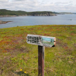
Grassy Point. Aptly named.
Chance Bay.
Founder Cove? Or Chance Bay?
Founder Cove.,
Lawler Bay?
Lawler Bay.
A view north along the coast.
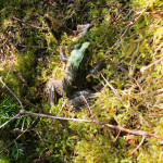
This little frog let me get very close.
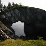
The aforementioned sign.
The arch from the sign.
Geologically the arch is fascinating.
Looking along the coast from the arch.
The view from atop the Berry Head Arch, looking at the signage… it’s the tiny white sign in the distance!
Little Gallows Cove.
Looking ahead at Little Gallows Cove.
Heading away from Spurwink Island.
South Head with Spurwink Island barely visible behind.
The viewpoint for Spurwink Island.
Heading out past the sign.
I think this is breaking down the next day.
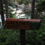
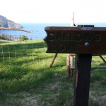
Gallows Cove, the site of the camp!
Not much of a view at Bruin Cove.
Croft’s Meadow.
White Horse River.
White Horse River.
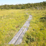
Planks cover the initial, marshy section.
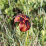
The march at the beginning of the hike is rich with Pitcher Plants.
The hike begins crossing an old overpass.
The trailhead for the more strenuous Spurwink Island Path.
The trailhead for the south end of the Mudder Wet Path is next to the trailhead for the north end of the Spurwink Island Path, behind a structore on route 10.
The main trail passes directly above the Little River side trail.
The falls at the end of the Little River side trail.
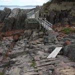
The new stairs to Little River and the falls.
Little River opens to the bay.
The wide path remains so for the length of the trail.
The trail starts with an ATV path from the end of Riverhead Road in Aquaforte.
The contrast of the sun on the hill and my shaded patch of sand.
The end of the road!
The Fisherman’s Memorial.
The Fisherman’s Memorial on the Stone Island side trail.
Approaching Calvert, Castle Point is beautiful and an interesting geological site, but you won’t want to climb it!
A look back at Cape Broyle Head about 10 minutes later.
The very satisfying view of Calvert from the top of Cape Broyle Head.
The one patch of ice left on the trail and it had to be on these stairs? Nice.
Blow Me Down. No view available.
Blow Me Down from a viewpoint approaching it.
The trails that are cut into these steep hills blow my mind.
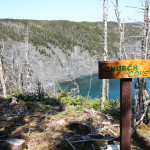
Church Cove.
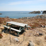
A picnic table in an open field seemed like a good spot for a break.
Some old-school planks!
Shag Rock Cove from the other side.
Shag Rock Cove.
The viewpoint offers a view of Shag Rock Cove and what I can only assume is Shag Rock.
At the 9 or 10 km point, Obvious signs of maintenance! Thanks ECTA!
A river crossing.
Lance Cove the next morning.
The climb back up is less fun than it looks.
One last look down the beach before climbing back out.
I could go no further! The north end of the beach went unexplored.
A vein of some mineral (quartz?) runs through the rock near the beach.
The view from the bottom of a gorge.
Little forms of life (some kind of sand flea?) dig little tunnels.
What a view.
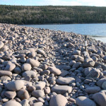
The “sand” is actually tiny beach rocks.
Erosion is a nonstop force on the ECT.
Lobster pots(?) near the sun-drenched cliff.
An absolutely spectacular destination for day one.
The steps at the bottom have seen better days.
The descent to Lance Cove Beach.
Well above Lance Cove Beach.
A sea stack in Lance Cove.
My setup!
In the other direction, Freshwater River (the water source for the camp) falls into a cove.
From the viewpoint beyond the Long Will campsite, the first view of Lance Cove.
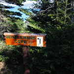
Gentleman’s Cove, hidden from view.
One of the few unobstructed views of the shoreline along this leg of the journey.
Large sections of the trail were like this or worse for the first 10 km. Note my pole at the bottom of the pic for reference.
Gallows Cove from above.
The North side of Gallows Cove.
Observe: the red blazes are your friends in these thick sections. Even more so when the thick sections are head height.
I got turned around once in the brush and ended up here… at least my dead end had a view!
Redman’s River.
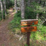
About 2km in, I see my first official signage.
This forest walk uphill sets the tone for the trail.
This is your goal: the rope is the unofficial trailhead. Scrabble up through the trees next to it.
Hikers should walk along the beach for three or four minutes.
This is the cul-de-sac referred to on the map. the trail to the beach is on the right.
Along South Side Road behind the Ultramar, an estuary and a bunch of gulls.
Waves crashing at the trailhead.
The setting sun provided some nice lighting for the end of the trail.
These steps, cut into the rock, fascinate me.
The falls at the end of the trail.
Damage to the trail by ATV riders.
The site of the memorial.
A memorial at a section of flat rock along trailside. Particularly sad that two friends died here.
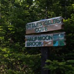
The river crossing at Half Moon Brook.
Half Moon Brook is the river that feeds the falls at the base of the Cove.
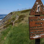
A second set of falls into rough seas at the end of Stiles Cove.
As the trail opens to Stiles Cove, the falls at its base are visible.
Now that’s not a nice name.
A look back at Small Point.
Small Point Cove.
The trail passes a grassy spot at Small Point.
A gulch on the approach to Small Point.
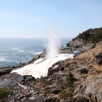
Spout River.
The crossing at Spout River is elaborate: maybe this river gets heavy in the spring?
A sad memorial to a hiking buddy.
The viewpoint at Cammy’s Point: new trail!
Black Head North.
From the bottom of Black Head Cove.
Crystal clear water in Black Head Cove.
Lots of birds on Shoe Cove Island today!
From the Grazing Grounds, Shoe Cove Island is visible for the first time.
A look at the Grazing Grounds beyond Shoe Cove.
Some kind of psychology experiment is still my guess.
The last time I was here, this hill was covered in ice!
The cutaway a km or two into the trail. Just so much unnecessary cutting.
Stepping onto the trail, the big seas and big sun made for a promising start!
From the Grotto at the Church where I parked.
An iceberg in Flatrock, the Beamer behind it.
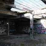
Now this is graffiti I can appreciate, beautifying a sewage treatment building 🙂
Hikers should be aware of the criss-crossing bike trail.
At the bottom of the hill, the trailhead!
The beautiful village.
Scenic Quidi Vidi gut.
The climb down to Quidi Vidi.
St. John’s from Bawdens Highlands.
Finally! What a view.
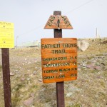
Bear this in mind, folks! We saw some riders on Father Troy’s Trail.
The start of the last climb, off the pump station road.
The trail crosses the road to the pump station.
A gulch just past John Howards River.
Past Joh Howards River, these vertical strata are fascinating!
John Howards River.
The river crossing at John Howards River.
Looking down at John Howards River and the rocky shore.
A gulch alongside the trail.
This grassy spot, as the ECT maps describe, is scattered with bleached bones.
Looking back at Sugarloaf Head from Robin Hood Bay.
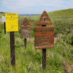
Good advice!
An interesting erratic near Robin Hood Bay.
This little rabbit let me get very close!
From the viewpoint near the landfill.
A climb down always means a climb back up.
Getting close to the landfill.
Much of the first half of the trail passes through shaded woods.
Off in the distance, near Cape Spear, a massive iceberg!
Success!
The trail passes close to a gulch approaching Sugarloaf Head.
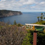
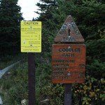
Scenic Logy Bay with the hills of Cobbler Path in the distance.
Looking ahead to Sugarloaf Head from the first viewpoint.
The view from the top is a nice reward!
The first 500m of trail consists of steep climb.
Even on this scorching hot day, a wisp of fog!
The trailhead is located in the Marine Lab parking lot.
The sun sets over Torbay as we reach the trailhead.
Heading down towards Tappers Cove.
Gallows Cove and the grassy fields at the end of Gallows Cove Road.
As the trail merges with the cart path, with private property on both sides.
Scenic Whale Cove.
From Whale Cove, looking towards Torbay.
A few fiddleheads poking up at the trailside!
From the start of the Church Cove loop, the massive bank of fog over Torbay Point.
It was very thick as we passed Turks Head!
The water is somewhere far below, hidden in the fog!
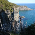
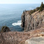
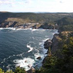
The trail follows the high cliffs.
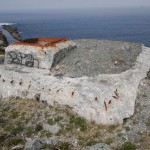
A WWII pillbox at the top of the hill past The Beamer.
The beamer, with folks exploring.
These massive erratics (once a single massive erratic) sit at the top of the Beamer side trail.
The trail (on the right of this picture) follows the flat bedrock.
A look back at scenic Flatrock.
The trail follows the flat rock of the coast, with the foggy hills of the Stiles Cove Path in the background.
The trailhead in Flatrock.
The sea stacks hosting an eagle family. The one to the left has the barely visible male in the tree above the nesting female.
From the rocks alongside the Spout. Check out the snow and ice: still remaining from a winter of spraying and freezing.
From the Spout River, the Spout is visible!
Another of the cliffs near Miner Point.
The trail passes close to gulches approaching Miner Point.
In Long Point Cove, an iceberg founders.
Around Long Point, the Spout is visible for the first time.
The back end of Long Point.
Looking out the gulch created by Long Point.
Heading uphill and inland.
The trail passes over flat rocks that are massive: a couple of hundred metres wide in places.
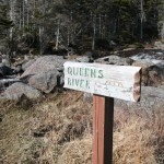
Queens River.
Queens River empties over flat rock into the ocean.
A bridge and river crossing early in the hike.
The site of a cabin at the end of Shoal Cove Road: the trail passes behind it.
The Spout Path trailhead at the end of Shoal Cove Road.
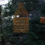
The Motion Path southern trailhead!
More structures near Shoal Cove Road. There is a grouse in the center of this picture!
The former site of structures at the end of Shoal Cove Road.
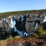
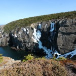
Raymond’s Gulch.
The twin falls of Raymond’s Gulch.
Passing over rock shelves.
A gulch along the final length of the trail.
The sharp turn towards the coast is indicated by sign.
The ATV path from Nippers Cove.
Nippers Cove, a cabin in the background.
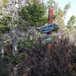
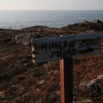
Miner Point.
Towards Miner Point, where the mine was actually located.
All packed up and ready to hit the trail at 7am!
Sunrise at the Miner Point Campsite.
The mosquitos were as big as hummingbirds!
My supper for the evening: Backpackers Gourmet Pad Thai. It was surprisingly good and filling!
Can’t ask for a nicer spot to spend the night!
The Miner Point campsite with plenty of time to spare.
Veins of quartz in the rocks near Miner Point.
The trail marker at the end of Pipeline Road.
The sewage outfall at the end of Pipeline Road.
Stone steps around another large erratic.
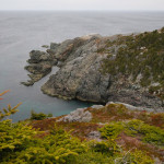
Looking back at Hartes Point.
The climb down the ridge on the other side of Hartes Point.
Burkes Head.
The climb to Burkes Head was one of the less gentle climbs on the trail.
Big Gulch.
Behind this erratic, snow is still visible along the protected ridge near Lower Cove Pond.
Trudging through snow at Lower Cove Head.
Lower Cove Head.
Kettles Cove, with Lower Cove Head in the background.
Atop these hills, much of the landscape is covered by these dense bushes.
A large iceberg below the trail at Pigeon Gulch.
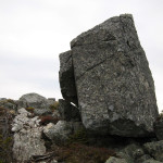
Some off the erratics, leaning at impossible angles.
The trail passes many massive erratics.
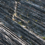
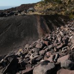
The bedrock in places along here is made up of this conglomerate. Makes me wish I knew more about geology.
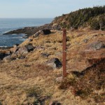
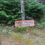
Motion Head, easy to miss, especially with the sign down!
Alexander Pond.
Watch for erosion along the trail between the Bight and Alexander Pond.
The debris from the ocean is found a significant distance from it.
The signage for the Bight is next to one of the bog rocks.
A river near Big Rocks.
Big Rocks. Aptly named.
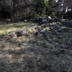
Driftwood, or the remains of a dwelling, at the Bight.
Heading towards The Bight.
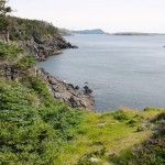
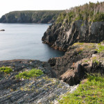
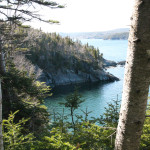
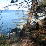
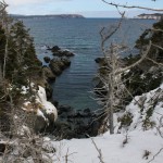
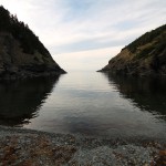
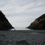
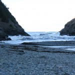
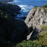
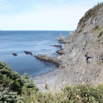
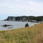
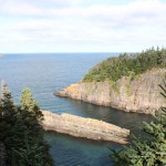
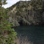
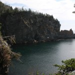
Siles Cove is indeed steep-sided.
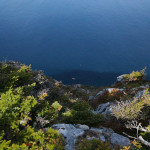
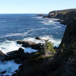
Passing around cliffs and gulches, the trail can pass close to the edge.
There are wet spots, bring your hiking boots!
Motion Head in the distance.
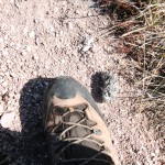
A massive owl pellet, next to my size 12.5 for comparison. It was full of bird bones.
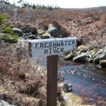
Freshwater River is scenic.
The trail passes many erratic fields.
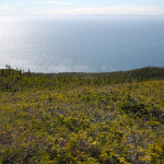
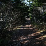
Much of the trail is easily hiked barrens.
The view towards Freshwater and the Bight and Motion Head in the distance.
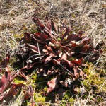
Pitcher plants can be found at various points along the trail.
The view of Maddox Cove from Big Hill.
The rocky path up over Big Hill.
The trailhead with the rocky trail aside it.
This walkway leads past a cabin to the trailhead.
Biscan Cove comes into view, and we feel droplets, so the camera goes away!
A last look back at the bergs from the north side of Big Cove.
The three big bergs from White Point.
This third one comes into view above Jacobs Cove, it’s in rough shape.
From the hill above Jacobs Cove/White Point, the view of this large, flat iceberg was much better.
Heading towards White Point, the second becomes visible.
A closer look at that first iceberg from Horrid Gulch.
The first view of the iceberg visible from Pouch Cove along the trail: before any climbs.
The bridge over the La Manche River.
A square cut at the site of the La Manche Village quarry. Stones were used for foundations throughout the village.
Looking back toward the Village from the Flamber Head Path.
Another large structure at the edge of the woods.
A larger structure at the edge of the village.
A small structure was found at the land’s edge. From here, more structures were built on stages over the water.
One of the foundations in La Manche Village proper, unfortunately marred by graffiti.
The remains of La Manche Village from the north end of the bridge.
The steps to La Manche Village.
Another sign of former residence, perched on a cliff’s edge.
The first (or possibly second) site of settlement along the trail, perched high on the hills to the north of La Manche Village.
The trail through the woods is lovely!
Exposed bedrock at the Doctor’s Cove side trail.
A view of an iceberg in one of the coves early in the Flamber Head Path hike from the Doctor’s Cove side trail.
Leaving the trail once they noticed our presence.
We often see Ruffed Grouse when we walk inland, but usually they see us first (and scare the crap out of us). These guys didn’t notice us, so we observed them for about 5 minutes!
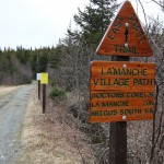
The trail to Lamanche Village starts just outside of Bauline East.
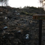
At the point where private property owners have cleared down to the trail, additional clearing has taken place parallel to the trail. A sad sight IMHO.
Coming back around Hollow Cove, my shadow on the hillside.
The steps down to Shoe Cove. Free from snow, a minor miracle! There are still a couple of wet spots so exercise caution.
Heading back to Shoe Cove.
The setting sun made the lighting spectacular for the return trip across the Grazing Grounds.
At Sandy Cove (I think), some evidence of erosion with this line of land that has sunk. Take care as this is close to the edge of the trail.
The view from avove Blackhead Cove.
Blackhead Cove.
No snow on boardwalks over river crossings!
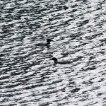
The Eiders were just off Shoe Cove Island.
I saw two medium-sized flocks of Eider Ducks, about 100 birds per flock.
Deadfall in the same spot, just past the Grazing Grounds.
The only deadfall I saw in the first 5 km of the trail, and there just happened to be a bit of snow there as well.
First view of Shoe Cove Island from the Grazing Grounds.
Shoe Cove.
The water level is very high.
The roaring river at Shoe Cove.
I expected to see snow in the woods! Even the community path at the switch here looks clear.
One of the gulches just before the trail dips into Shoe Cove.
Under the large, odd tree halfway to Shoe Cove, the last of the snow.
Still wondering what this thing is. Used to measure depth of snow perhaps? Walking by it yesterday, I started to think it might be a psychological experiment: to get people to take pictures of it and guess what it’s for.
Hollow Cove.
Loud cracks could be heard as the last of the ice melted away.
Looking out Hollow Cove.
Ice and meltwater on the walls of Hollow Cove.
One of the gulches on the approach to Hollow Cove.
A spectacular day.
The few spots that till had snow were packed down.
An uncovered boardwalk? Heaven!
No snow as the trail dips into the woods… so far so good.
A bright beautiful day on the Trail.
Drift climbing around gulches where the snow gathered.
Untouched by human feet.
The sunset over Brigus South was spectacular.
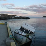
Some poor soul lost his boat at some point this winter.
The old road back was basically just a river. Luckily it wasn’t too long.
The summer homes at this end of Admirals Cove have a spectacular view.
The beautiful Island Cove.
From here, the quad traffic had at least beaten down the worst of it.
The last challenging part of the trail behind me, an uphill in deep, soft snow.
just past Shitting Gulch.
Approaching Shitting Gulch, a tree blocks the entire path.
After a long time with my camera packed: a shower passed overhead and I put it away until the sun was obviously sticking around again. A look back at Bills Tar Cove.
The view at Cross Cove.
…of which there were the evidence of many. From about Brigus Head on, the trail showed evidence of constant use throughout the winter.
River crossings were challenging. At least once I was just following the moose.
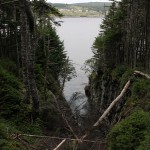
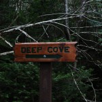
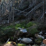
Looking back at Deep Cove.
More deadfall.
Some damage near Deep Cove.
Another shot of deadfall on the trail.
I tried to capture both the location and magnitude of the deadfall above Black Cove. Hikers have to leave the trail at multiple points along this stretch avoiding deadfall. Hats off to the volunteers who have some work ahead of them.
The sign is down at Brigus Head. Just keep going straight at this 4-way junction, hikers.
A look forward to Cape Broyle Head.
A look back toward Tors Cove.
I didn’t want to get too close to viewpoints such as this one at Hare’s Ears.
Approaching Brigus Head, things started to clear out a bit.
A look back at Brigus South from above Herring Cove.
Deep snow alongside Herring Cove.
Leaving the old road, the trail is immaculate, unhiked for the last while.
The old road is pretty much just a river even at the ECT section.
…as in this picture.
The trailmarkers were welcome sights and made good gauges of the depth of snow.
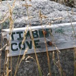
Timber Cove is looking spectacular.
The first river on the trail is just past the Timber Cove signpost.
From the trailhead, the patchy melting and soft snow is visible.
The trailhead in Brigus South.
A little cabin porn. What a secluded spot at the end of Mickeleens Path.
Snowshoe marks from the couple I passed on the way in mark the trail from the Old Track to the start of the Mickeleens Path.
The track I had followed climbed out of the woods onto the Old Track.
The snowmobiler must have been a little nervous skirting this hole.
A pair of snowshoes that had been lost along the Old Track close to Bay Bulls. Perhaps they fell off the back of the snowmobile.
A tunnel through the trees.
The Old Track was nice for snowshoeing once off the snowmobile track.
At this clearing, I decided to turn around: I couldn’t get motivated to head into the drifts on the other side.
The Old Track had opened in a couple of spots.
Turning around at the branch, the upper trail didn’t look much better.
Some spectacular views as the trail crosses hills above gulches.
Working my way back through the heavy drifts in the trees.
This is where I chose to turn around. It’s not clear from this picture but immediately on the left of the trail there is a drop into a gulch. I didn’t want to attempt it alone.
More deep stuff as the trail winds around the first of the gulches at the 1km point.
The sun, which stayed hidden for most of the trip, came out in time to make this river crossing spectacular.
In the trees, things were a little more challenging.
The clear spaces were deceptively pleasant.
Some big drifts early in the trip.
Snowshoes most definitely necessary. I was glad to see someone had been here already.
The trail begins innocently enough…
I moved the snow that had been plowed in front of the sign.
Ragged beach and the Witless Bay Trailhead 5.5 hrs later!
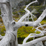
Interesting how trees will grow around one another!
The south end of Breaking Beach.
More of the “find the plank under the pillars of snow” game!
Side trails went unexplored.
Nolan’s Meadow was bright and beautiful, but cold… the wind had picked up!
Stairs… the nemesis of the snowshoer who is too lazy to take his snowshoes off!
Some kids played on the beach on the other side of the Mobile River.
The trailhead! Time to head back!
The rough seas had pushed plenty of seaweed onto the ice.
Bleached bones of something, I’m thinking seal.
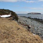
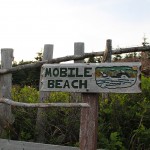
Mobile Beach!
Entering the woods just outside Mobile, leaving Nolan’s Meadow.
The “cross the plank walkways” game was always fun!
More of the sunlight on the untouched trail.
Not so much pleasure.
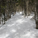
The immaculate trail was a pleasure to walk.
The same raven tricked me with his “coo… coo” call last year, I’m sure of it!
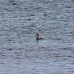
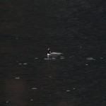
This loon-looking bird (identity coming!) dove at around Webber’s Cove.
Past Breaking Point, no human footprints on the trail, but at one of the gulches near Little Bald Head, a LOT of moose prints!
Looking back at Breaking Beach from Breaking Point, metal remains from the wreck of the Apenine are visible.
The far end of Breaking Beach from Breaking Point.
Some of the deadfall the wonderful volunteers will have to deal with.
Trying to recreate the cover page picture. Not quite the same!
A little beach is visible at Breaking Beach.
Upper Long Rock Cove maybe?
Some brave souls had gone as far as Breaking Point without snowshoes. Most of the trail was fine but they went through a couple of times.
The crossing at Camel Beach is pretty, but be careful on those big clunky snowshoes!
The first look at Camel Beach.
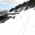
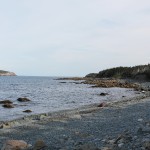
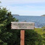
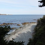
Twelve O’Clock Beach isn’t looking very “beachy.”
Up over the hill from Peters Cove into the woods towards Twelve O’Clock Beach.
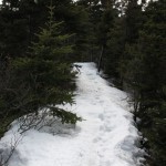
The trail was snow covered as it entered the first patch of woods.
This nice couple and their cute puppy started on the trail when I did.
Rough seas near the Mobile trailhead.
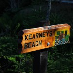
Kearney’s Beach is snow covered.
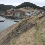
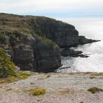
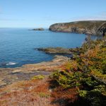
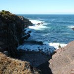
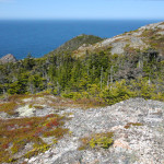
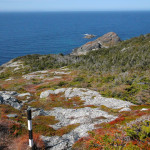
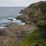
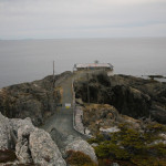
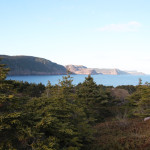
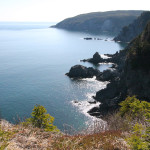
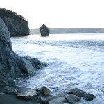
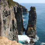
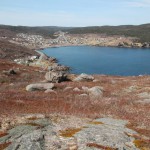
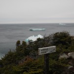
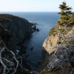
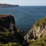
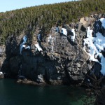
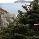
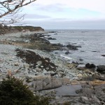
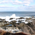
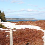
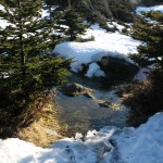
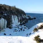
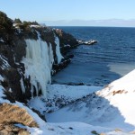
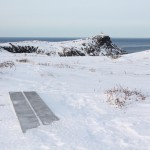
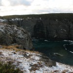
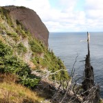
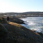
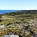
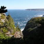
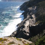
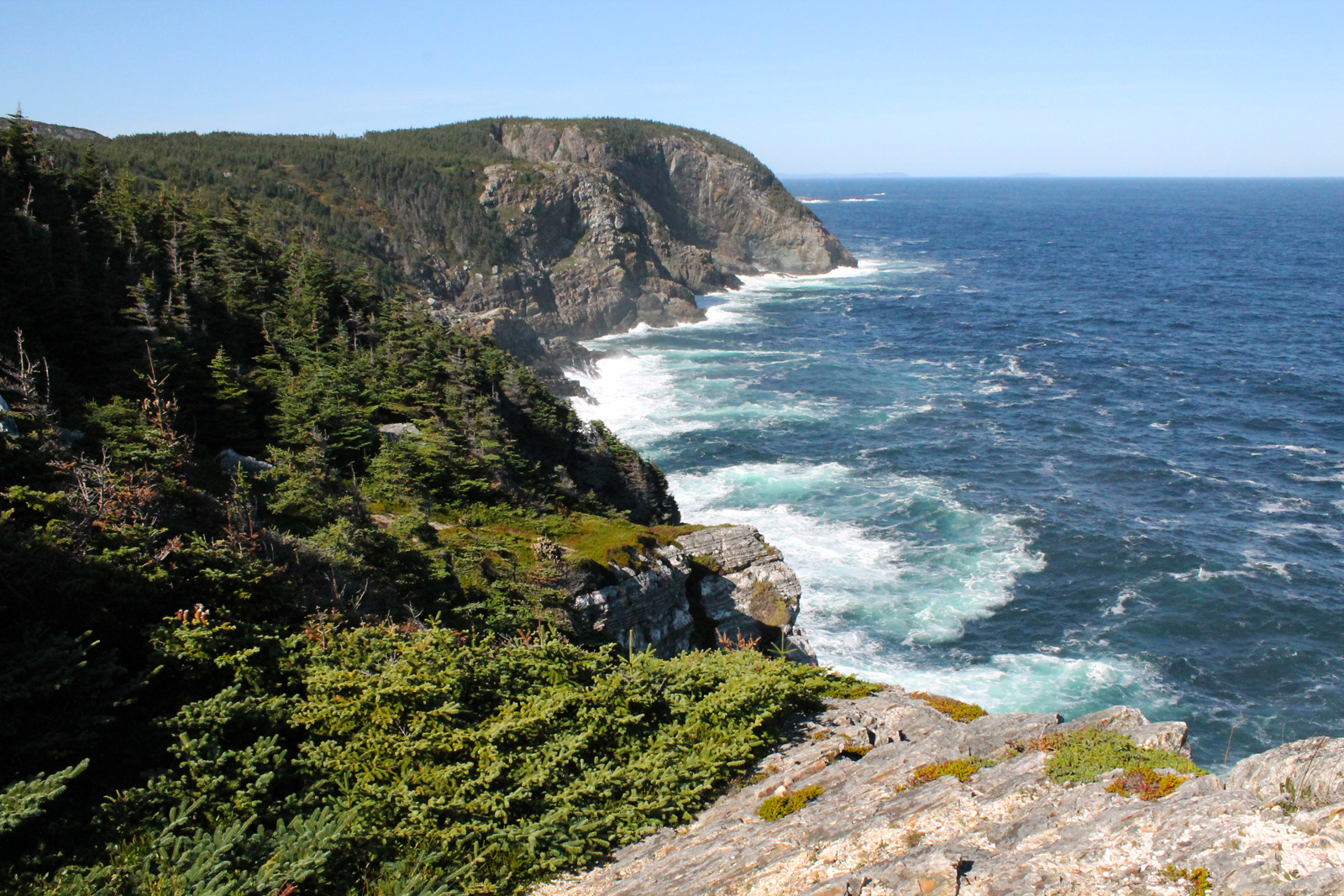
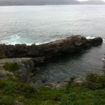
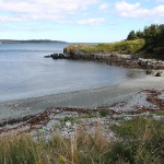
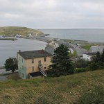
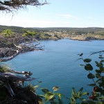
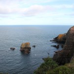
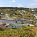
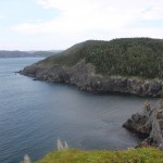
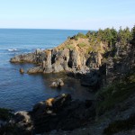
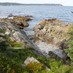
The sun shining on Tinkers Point made for a spectacular view.
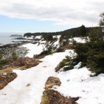
The rocks beyond Tinkers Point.
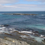
More of the ocean around Tinkers Point.
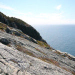
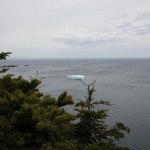
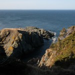
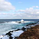
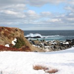
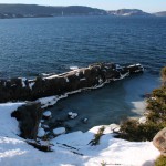
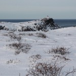
Right alongside where I stood, the seas were huge!
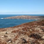
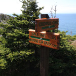
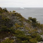
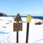
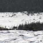
Crossing the back end of Tinkers Point, Mobile Point and the Beaches Path in the distance.
Big seas at Tinkers Point!
The log seats at Neil’s Cove.
Many of the bridges and plank crossings are becoming free of snow.
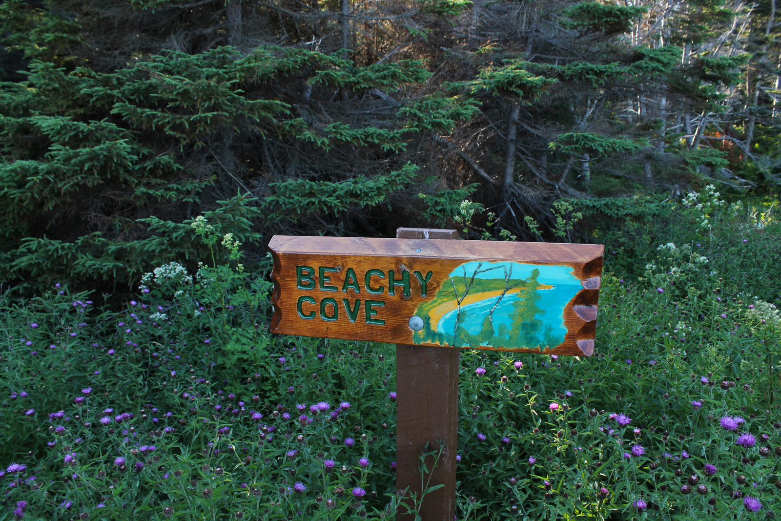
Looking back at Beachy Cove and the now open river.
The far end of Beachy Cove.
Fox Island from the branch heading to the beach.
The Cribbies, my mandated destination.
One of the houses near The Cribbies.
Heading inland toward Tors Cove, the trail makes a sharp right as it joins a community trail.
Another mini spout at the cobblestone beach accessible from the trail at Beachy Cove. Check out the seaweed that has been transported out of this hole!
A closer look at the pool that the water sprays out of.
A mini spout just past Vales Meadow.
I tried to stick to the snowshoe path, but went through: the marsh has thawed!
More big seas!
A brief flurry as I walk towards Kearney’s Beach through the woods.
Toward Kearney’s Point, with one of the islands of the Ecological Reserve in the background.
The waves were large!
Deep cove is spectacular surrounded by ice and snow.
Small river crossings have begun to thaw and can be a tricky combination of ice and rocks for snowshoers.
The view out over Cod Seine Cove toward Deep Cove.
Past a cabin and a wide stone bridge, the trail proper begins.
The trailhead at the end of Cod Seine Road in Mobile.
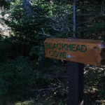
The trailhead in Blackhead.
A look back at Blackhead and the slob ice in the bay.
The usual wet spots are pretty wet.
Almost back, the trail was easier to follow on the return trip. Bottle Cove maybe?
A look at the viewpoint at Cantwell’s Cove.
Crossing an open stretch, the trailhead at last!
Slob ice in Pilot Gulch.
Ice in Paper Cove.
Slob ice in Paper Cove.
Close to the trailhead, some slob ice in the coves and gulches near it.
Snowshoes necessary.
Some spots have opened up. Some hikers plow right through.
A couple of hikers enjoying the weather.
The first view of the trailhead.
The snow has melted to reveal planks in a couple of spots.
A look back at Blackhead from the south.
The trail markers make it easy to stick to the trail on the other side of Blackhead.
The second dummy fort.
Rounding the top of brown, windblown Blackhead, Cape Spear is striking.
Blackhead.
The first dummy fort at the top of Blackhead.
The trail is easier to follow from here.
At the top of the hill, the sign looks to have been damaged this winter.
A look back at Blackhead. It’s a bit too bright to see much detail, but trust me, there’s not much of a trail here.
Slob ice at the bottom of Blackhead Bay.
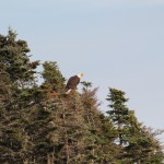
A mature and immature bald eagle said hello!
Above the Parks Canada building at the parking lot of the Cape Spear site…
The Cape Spear Path beckons in the distance.
The sun reflecting on the crusty snow was worth seeing.
Massive icicles on the cliffs near the Cape Spear Path trailhead.
The sun is starting to get low over the trailhead as I make my way back.
One of the few exposed boardwalks within view of Cape Spear.
Snowshoes necessary!
A look back toward Cape Spear from the ridge above Sharks Point. I tried to capture the wind which was a deciding factor in my turning around here instead of at Staffordside.
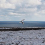
The best shot I got of the poor snowy owl I frightened, flying over the Cape Spear Path trailhead. I didn’t see him until I was on top of him.
Footsteps leading to the lighthouse.
A not insignificant amount of traffic had made its way to the lighthouse.
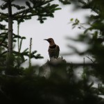
A Northern Flicker greets us as we walk through thick woods.
In the distance, Fort Amherst and Signal Hill are visible.
Another angle on Peggy’s Leg, where the birds are more visible.
The trail marker for Peggy’s Leg.
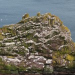
Peggy’s Leg, home to many seabirds.
Pretty flowers.
The trail marker at Shoe Cove.
Beautiful Shoe Cove.
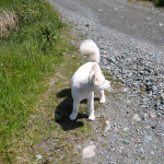
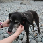
Heather is always greeted by a dog.
It’s not always rough at Shoe Cove!
This huge and bizarre tree can be found on the trail to Shoe Cove.
A closer look at the trail marker at Hollow Cove.
By the time we returned to Red Head, snow had started so the camera went in the bag.
Red Head Cove from the south.
The snowy trail past Red Head.
Past Red Head, deep gulches and foreboding seas.
A snowy owl on Red Head.
The view of Red Head from the south.
Looking down at Flatrock from the top of the final descent (or ascent in the direction we were headed)
The side trail just outside of Flatrock is scenic.
Snow covered boardwalk.
Big River from the bridge.
Climbing to Big River, stairs are cut directly into bedrock. Saves on maintenance!
Crossing the rocky shore to Big River.
Heather heads to the rocky shore behind the trailhead.
Hikers are asked to park at the church in Flatrock.
Watch out, birds!
It was very windy!
Rough seas as we enter the fields behind Pouch Cove.
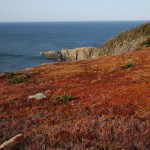
The fall colors were certainly starting to show!
Rough waters at Shoe Cove!
The trail marker at Shoe Cove.
Heading back down the descent to Shoe Cove.
Here it meets an ATV trail and heads downhill into the woods.
The trail opens up onto Black Head North.
The trailmarker for Blackhead Cove.
Blackhead Cove is visible for the first time.
The Shoe Cove Island trail marker.
Waves crashing on Shoe Cove Island.
The wind whistled up out of this narrow gulch as we walked by.
Shoe Cove Island is first visible, surrounded by white water.
Past the climb above Shoe Cove, the trail opens up.
The view of the river into Shoe Cove from the bridge. It was rough this day!
The first switchback as the trail descends to Stiles Cove.
A last look back at Pouch Cove as we round a gulch.
Entering the woods, we see this thing, solid wire, about a meter in height… anyone?
Very rough seas as we pass the edge of the gulch!
The trail marker at Hollow Cove.
A waterfall makes its way over the edge into Hollow Cove.
The trail passes rocky coastline as it approaches Hollow Cove.
The end of the line. I guess this guy has the unfortunate circumstance of living on one of the only trails frequented by hooligans who like to deface buildings. I feel for the guy, but it’s a shame that those folks ruin it for those of us who believe in leaving no trace.
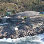
A close-up of the Marine Lab.
Nearing the end of the open trail, Memorial University of Newfoundland’s Marine Lab is visible, as is “the castle”… not trying to look in anyone’s windows or anything, but it’s hard not to get it in this shot!
Again.
More “juvenile recreation.” There’s no need.
More remains of the former military sites.
Leaving the Redcliff Head site, we’re at a high elevation.
The inside of the ruined building at the first gun battery site.
I actually do like graffiti art, but there’s a time and a place, and historical buildings aren’t really it.
“Juvenile recreation” indeed.
The gun battery had a great view of the surrounding ocean.
The entry to the sunken gun battery at the summit of Redcliff Head. “Juvenile recreation” (I love that descriptor for vandalism used on the ECT maps) visible inside.
Coming up out of the valley where the Cobbler is found, you can see the rough seas.
The ocean was HUGE this trip out. It was very windy.
The Cobbler: I’m never sure exactly which rock bears this name 🙂
Cobbler Brook as it empties into the ocean, an easy rocky crossing.
After a downhill stretch, the trail crosses Cobbler Brook.
The view of Torbay Point from well above it.
At the top of the first climb just beyond Torbay Point.
Hikers about halfway out Torbay Point.
Early in the summer, we spotted many, many whales from the top of the hill just beyond Torbay Point; we were even lucky enough to see a few breaches!
Beachy Cove, a scenic spot on the trail!
The trail follows the coast through patchy woods along a property marked by wooden fence.
The first viewpoint is at Crow Island.
No matter what old road you’re on in NL, you’ll unfortunately find one or two of these.
Continuing past Southern Head, the islands of the Witless Bay Ecological Preserve are visible in the distance.
A cute little house (half a salt box?) in the community of Burnt Cove, where parking is available.
From the top of False Cape, Freshwater Bay is visible for the first time.
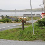
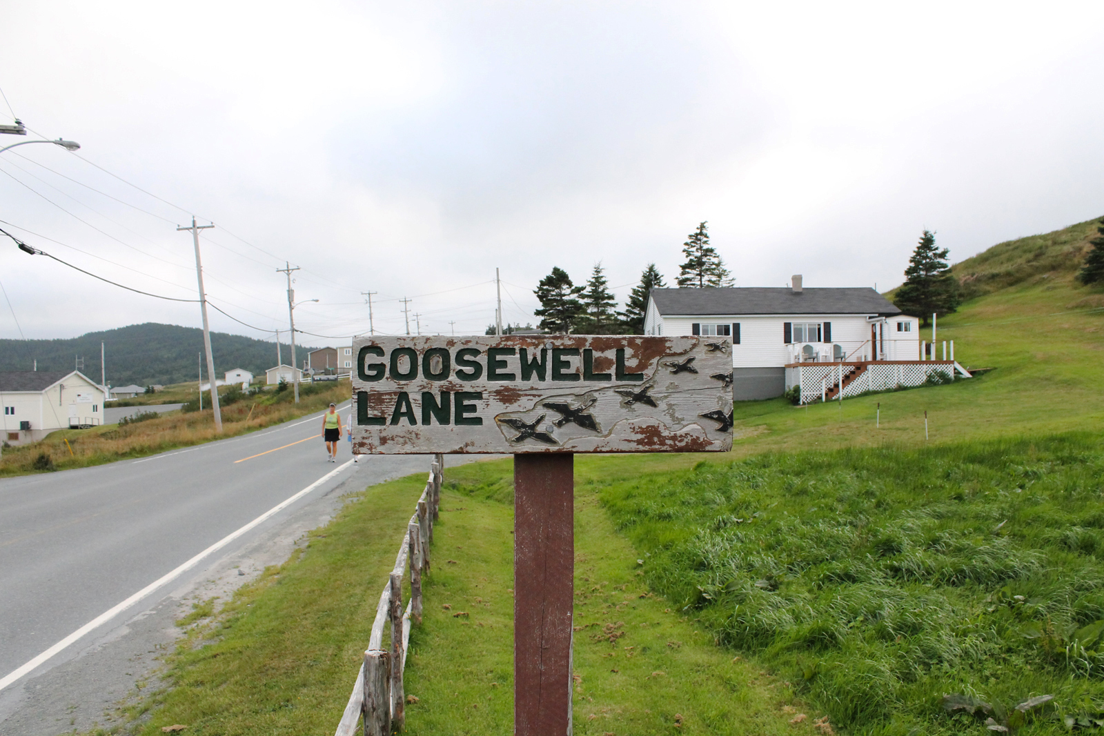
Goosewell Lane is the route to the railbed.
Around a chainlink fence at the Baltimore School.
The remains of an old shack at a rocky river crossing.
Success! The trailhead in Maddox Cove.
The first lighthouse, automated if I recall correctly.
A viewpoint a few metres away ends at an overgrown cliffside.
The view from the headland as hikers round the edge of Biscan Cove is spectacular.
The view north from the viewpoint.
He was none too pleased to see us! Taken from the Herring Cove path.
…but be careful of the precipitous drop at the end of the Head.
An old cemetery on the road back to Pouch Cove.
The road to the Cape St. Francis lighthouse and the Cripple Cove Path.
The lighthouse, and the future trailhead for the Cripple Cove Path, are 500m beyond the trailhead. We were down there the week before and since there are few photo ops we opted against doing it again.
At the site of the former United church.
The trailhead at Cape St. Francis.
The fallen tree in the pool behind the concrete pillar that must be crossed.
Pigeon Island in Biscan Cove.
The trail marker at Pigeon Island.
The final river crossing.
A wooden bridge makes for an easier river crossing.
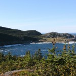
Biscan Cove from atop the final climb.
First look at Biscan Cove.
The view from the headland as hikers round the edge of Biscan Cove is spectacular.
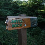
So named because it looks like an anvil.
The trailmarker at Anvil Rock.
Polly Butt’s Gulch.
Some crazy waves in Bog Cove!
The view of Big Cove from White Point.
White Point, white waves behind it.
There was a little trouble crossing Freshwater River for a couple we met on the trail.
Freshwater River.
The waterfall and the view north from the Freshwater viewpoint.
When we arrived at the Freshwater viewpoint, the waves were so vigorous they had kicked up mist at the waterfall!
Coaker’s Gulch.
Coaker’s Gulch.
An eagle watches from the trees on Big Bald Head.
Incredible to think someone scaled these cliffs in stormy conditions.
The viewpoint at Horrid Gulch, where a spectacular rescue was conducted.
A river where a community ATV trail meets the Biscan Cove Path.
North from atop Little Bald Head.
The trail continues to the right. Doesn’t it look like it should continue straight? This is where we went astray on our first attempt.
A look back at Pouch Cove from Little Bald Head.
The view north from the viewpoint.
The trail scales this short rocky section before meeting the Water Witch trail and a side trail to a viewpoint.
Traversing over rocks at the start of the trail
As the trail exits the woods and the fenced private property, a gulch appears on the right.
A gulch, Paper Cove maybe, at the end of the hike.
A cobblestone beach near the end of the hike.
Cantwells Cove, off the main trail.
The remains of the dummy fort at Blackhead.
The view of Cape Spear from Blackhead.
Atop the hill, an old track leads to Blackhead.
Bottle Cove maybe?
The trail heads inland and uphill relatively quickly.
Hikers should leave the horses alone!
The trail rounds the private property.
The trail starts at the end of a private drive. The bare-legged hikers in front of us got pretty cold… be prepared folks!
A gulch near the end of the trail, maybe Paper Cove.
A cobblestone beach near the end of the trail.
Cantwells Cove.
The remains of the dummy fort.
The view of Cape Spear from Blackhead.
Atop the hill, the headland known as Blackhead.
Bottle cove maybe?
The trail starts uphill relatively quickly.
The end of the horse pen. Hikers should leave the animals alone.
Winding around the private property.
The trail begins at the end of a private drive. Check out the bare-legged hiker in the distance: those folks were caught unprepared by the cool weather! Dress appropriately for NL hikes!
The beautiful sunset as we left the trail.
Spout River, which ended up our final destination.
The wetlands are lit beautifully as the sun begins to set.
The trail passes close to the road as it bridges a riverbed.
The marking as the trail passes over the beach at Fairmouth Cove.
The trail is constructed into some steep hills at points.
One of the rivers (Stony River?) emptying into Fairmouth Cove.
The beach at Fairmouth Cove.
Heather is always impressed when the trail passes over loose rock.
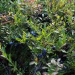
The blueberries tasted like candy!
Aquaforte Harbour below.
A steep climb is rewarded with a spectacular view.
The trail opens up to this large meadow.
Grassy viewpoints appear in a number of places along the rocky coast.
The viewpoints offer a view of the rocky coast in both directions.
A field of cotton balls!
The side trail at Herring Cove Island. Looks safe! 🙂
Crow Island from the rocky Sounding Hills Path.
The first viewpoint is at Crow Island.
The view of Ferryland Downs from the rocky coast opposite it.
A memorial to Ambrose Jordan Jr. at the trailhead.
The cove at the trailhead.
A pretty river empties into the cove at the trailhead.
A cormorant floated and dove in the cove at the trailhead.
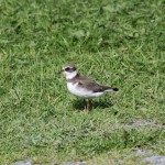
A (semipalmated plover perhaps?) at the trailhead. I’ll narrow that down once I confer with Heather 🙂
Lush greenery!
The setting sun made for some interesting lighting on the return trip!
Boardwalk and lush greenery on the section between Calvert and Ferryland.
A structure just past Lance Cove.
Deep, dark woods on the walk back!
Around a chainlink fence at the Baltimore School.
The trail continues alongside a road in Ferryland.
Heather is greeted by a dog in every community!
The beautiful coastline as the trail enters Ferryland.
Passing through Ferryland along roads, the trail is well marked.
the only wrought-iron fence in the cemetary.
One of the few remaining gravestones.
The cemetary alongside the trail is old and overgrown, with simple stones marking most graves.
Goosewell Lane is the route to the railbed.
The trailhead in Ferryland!
This widening of the trail is the only indication of where hikers should leave the railbed.
A huge flock of gannets, diving in unison!
Ferryland Downs and Ferryland Head from the trail.
The T’Railway.
Goose Island? Shrouded in fog, at any rate.
The view from the railbed above Ferryland is pretty spectacular.
The trail exits onto a road in Ferryland.
Heading away from the softball field into Priests Farm.
The trail marker is near home plate on the 3rd base side.
After passing the school, signage indicates where to go, around the softball field.
The view from Gunners Point.
Indian pipe growing on the trail.
The trees were thick and the woods was dark!
A beach at what I think is Lance Cove.
The trail crosses over a dry river bed.
A smart piece of advertising at the base of a tree!
The trail meets a road and hikers are instructed to stay alongside it.
Trees had fallen into the end of this gulch.
One of a couple of river crossings in the woods section of the trail. We saw a grouse at this one!
The sign as the trail approaches Deep Cove from the south.
Deep Cove beach at the bottom of the first hill.
The trail descends through thick woods along a ridge.
Returning to scenic Brigus South.
The first portion of the Old Southern Shore highway on the return trip is uphill.
As the trail widens into a gravel road, Admirals Cove is visible at the bottom.
The trail opens up overlooking Island Cove.
Heading inland, there are a couple of branches to community trails, such as this one at John Denines Path.
A look back at the gulch from the bedrock of the trail.
The trail passes this interesting gulch over exposed bedrock.
Stairs at Shitting Gulch (no joke!)
A look back at Tar Cove.
These rocks are probably remaining from human activity at Reddys Tar Cove.
These berries are in a few spots on this trail and everywhere on Flamber Head Path. Anyone know the NL name for them?
Spectacular Tar Cove Beach. We watched a pair of loons dive for food and gannets and terns flying above.
The sign marking the side trail to Tar Cove beach.
Rock piles that indicate human activity at Bills Tar Cove.
The stone path at the bottom of the wet meadow that was once Bills Tar Cove.
Point Dennis in the setting sun.
There is apparently a memorial at Cross Cove (according to the map) but I can find no info about it.
Cross Cove offers a beautiful view.
A viewpoint a few metres away ends at an overgrown cliffside.
The cliffs at the back end of Tar Cove Point Cove.
Tar Cove Point and the rock ledge at the end of the side trail.
Looks to be the leftovers of a bird kill over the rocky shore of Tar Cove Point Cove.
The rocky end of the Tar Cove Point Cove side trail is worth exploring.
A river crossing in front of the worst case of storm damage I’ve seen on the trails this year.
Deep Cove, its deep bottom obscured in the shadow of the cliffs we were standing on.
Deep Cove is visible from the south.
Deep Cove from the north side is obscured by trees.
The perspective was also hard to capture on film at times: this is the view from the trail, essentially straight down at the water 100 m or so below. You’re looking straight down on those gulls 🙂
Many of the coves, like Black Cove, were difficult to capture in picture form because of the tree cover.
Brigus Head. The trail from the sign is apparently a bird hunting trail, at the end of which one must traverse the cliffs using rope… no thanks!
The view of the cliffs of the Cape Broyle Head trail. Looking forward to this one!
Hares Ears.
The Hares Ears viewpoint is worth checking out.
Little Hares Ears maybe?
Looking back at Brigus South from over Herring Cove.
Herring Cove beach.
Herring Cove, home to nesting eagles.
The trail heads left as the Old Southern Shore highway heads straight.
Looking back towards Timber Cove.
Looking back at Brigus South from Timber Cove.
The beach at Timber Cove, an odd structure on one end.
The signage upon entering the vicinity of Timber Cove.
A cormorant chills on the rocks of Timber Cove with a couple of gulls.
Timber Cove and the cliffs beyond.
The trail begins as a cart path, passing berries, roses, and more.
The approach to Motion River from the south. Perhaps the rocky beach would be the way to pass this point!
The end of the improved trail.
The concrete structure at the end of Freshwater. A sewage outfall perhaps?
A look back at rocky Freshwater.
The Houlihan’s River crossing.
Houlihan’s River and the path down to it.
The bench at Houlihan’s River.
Freshwater, where Houlihan’s River deposits. Quite a view for the property owner.
At the end of the cliffs, Houlihan’s River and Freshwater are visible for the first time.
The sea cave is visible below.
A trail marker keeps hikers away from private property.
The trail heads uphill alongside some spectacular cliffs.
A trail marker on the approach from the north keeps hikers from following a trail that founders over the edge.
When the trail approaches the cliff edge, the views pf Middle Cove are spectacular.
Meadow and woods at the start of the trail.
The trail starts through woods.
A look back at the beach from the trailhead shows how popular it is.
The Middle Cove Beach trailhead is in the meadow at the top of the rocks.
Heather scales the rocks at the back of Middle Cove Beach.
Another look at the cliffs behind Motion Drive.
Motion River wasn’t easy to cross so we headed back.
We were warned! The only real issue on this section is the Motion River crossing.
Sheer cliffs behind Motion Drive.
A meadow behind private property on Motion Drive.
The trail starts with some spectacular cliffs.
A rock pile at the access trail back to the trailhead at the end of Quay’s Road.
The wet Old Track offered a few obstacles.
No matter what old road you’re on in NL, you’ll unfortunately find one or two of these.
Heading back along the old track, essentially a cart/ATV path at this point.
Heather always manages to attract a local greeter!
The trailhead in Witless Bay.
The trail winds through meadow in Witless Bay.,
Houses at Bears Cove have a spectacular view of Witless Bay.
The first signs of private property are usually old stone property lines.
The rocks at Horses Back were loud as the waves crashed over them!
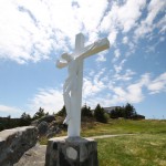
A beautiful memorial for a very sad event.
The site of the memorial for William Tobin, Jr., only 16 years old.
The trail passes over a brook and over rocks.
Unmarked, probably Monahan’s Gulch.
The marker for the side trail at Otter Cove.
The beautiful falls at Otter Cove.
The trail marker at the Otter Cove viewpoint, the site of an old otter run.
Mutton Cove from above.
The trail marker indicating Mutton Cove.
Rocks at Carey Cove.
Heather walks out of the dark woods towards Mutton Cove.
Lower Red Cove, the sight of spectacular red rocks used as a navigation tool by fisherman.
The Fiddler, a deep gulch past Southern Head.
Continuing past Southern Head, the islands of the Witless Bay Ecological Preserve are visible in the distance.
South Head, or Southern Head according to the map.
Southern Head Cove from above.
The meadow on the approach to Southern Head.
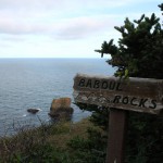
Baboul Rocks are apparently spectacular when the sea is choppy.
The Baboul (the root of the name Bay Bulls?) Rocks lookout.
The lookout at Chest Cove Point.
A waterfall at Chest Cove.
Through lush ferns.
The trail passes a few babbling brooks via rock bridge.
Another view of Island Cove from above.
The trail passes a meadow at the top of Island Cove.
Island Cove sign from the north approach.
The first view of Island Cove.
Stone path and steps.
The boardwalk is particularly well done on this trail.
Heather cleans off some raspberry bushes and moves on. These lush bushes are on both sides of the trail for the first 1km.
The old trailhead for “Mickeleen’s Walk.”
The trailhead in over the path.
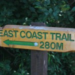
The trail begins 280 m from the turnaround.
Finally, the trail descends into beautiful Brigus South.
The trail heads over rock and back onto land at Long Point Gulch.
Either Horse Gulch or Long Point Gulch, either way, massive!
The stone path through the wet ground along the shore.
The trail descends over bedrock, requiring some climbing.
Brigus South is visible for the virst time from Frenchman’s Head.
Frenchman’s Head, where the trail turns towards Brigus South.
The best look at Grumpy Man I could get without being unsafe. At least you can see that it’s separate from the mainland.
The viewpoint past Soapy Cove provides a view of Grumpy Man, a rock at the end of Soapy Cove.
Soapy Cove from the trail above.
The trail turns sharply above Soapy Cove.
The Southern Shore spread out from Deep Point.
The viewpoint at Deep Point offers spectacular views.
A look back at Deep Cove from a side trail aside it.
Past Deep Cove, another river crossing and steep ascent, commonplace on this trail.
The pair of loons, one diving and the other watching.
Flapping!
One of a pair of loons diving in Deep Cove.
The morning sun lights Deep Cove.
The trail descends to the cliff-protected, picturesque Deep Cove.
Hares Ears and Johnny Hayes Point on either side of Deep Cove.
A viewpoint at High Cliffs.
Plenty of wet patches with rock crossings. Watch for the shifty rocks!
Jefferies Gulch, just beyond the campsite, the morning sun shining in.
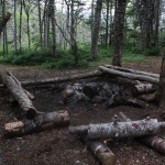
The Roaring Cove campsite, tent platform in the background.
A look back at Roaring Cove from Jefferies Point.
Packed up and ready to go!
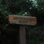
Marking Roaring Cove River, crossed on rocks.
This sign was a welcome sight at the end of the first day!
The trail winding up over Flamber Head. Don’t skip this side trail!
Cape Neddick and False Cape at the other end of Freshwater Bay.
A spectacular sea stack at Flamber Head.
A gulch at Flamber Head.
All of Freshwater Bay is visible from the top of Flamber Head.
Morning at Roaring Cove.
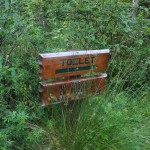
Toilets exist though I didn’t check them out.
Despite “no open fires”, there have obviously been a few.
My Katadyn water filter was also a godsend after dehydrating myself on the march in! Roaring Cove River provided deliciously cold water!
The next morning. This camping platform was a godsend as light was getting low!
The bridge over Freshwater River at the bottom of the bay.
The spectacular rapids at Freshwater River, where the trail crosses a rocky beach.
The gulch and meadow at Gentlemans Head.
The side of Gentleman’s Head as the trail approaches it.
From the top of False Cape, Freshwater Bay is visible for the first time.
The side trail to the top of Cape Neddick. I was pressed for time and continued on, sadly.
Cape Neddick Gulch, on the south side of Cape Neddick.
The trail skirts the gulch at Cape Cove at the north end of Cape Neddick.
The first view of Money Cove Point and Cape Neddick is spectacular.
The trail markers are a little older than on other trails and are a welcome sight.
The islands of the Witless Bay Ecological Reserve are visible from the high trail.
A steep descent over wooden stairs.
The first scenic gulch at Bluff Head Cove.
A rest point at 0.9 km might seem early in the hike…
One of the many river crossings.
One last look at calm, beautiful La Manche Bay.
The first of many climbs is a wooden staircase constructed over the rocks by ECTA volunteers.
The foundations that remain are a mix of stone and concrete.
The trail begins along a sheer rock face.
I happen to like graffiti in general, but tagging something historic and irreplaceable like this is not okay.
From the location of the Village, the suspension bridge on the La Manche Village Path is spectacular.
The foundation of a house in La Manche Village.
A pool in the La Manche River just behind the community.
The first signs of settlement as we enter La Manche Village.
The access trail into La Manche Village passes over the bedrock the Village is perched on.
The suspension bridge from the trail overlooking La Manche Village.
The suspension bridge was built to replace the destroyed bridge.
The suspension bridge from the former site of La Manche Village.
A cute little house (half a salt box?) in the community of Burnt Cove, where parking is available.
The sign on the Tors Cove side of Deep Cove.
This one, close to the trees, looks like the other.
This depression looks to me to be one of the root cellars at Vales Meadow.
A stone well at Vales Meadow, spotted second time through.
The thistles at Beachy Cove.
The Cribbies as seen from the Lower Beach branch as we head back.
Lower Beach and Fox Island from the high point of the trail.
There is some erosion at the “cliffy” section, to be fair… hikers should exercise care.
Sacred Heart Church.
Greeted by a local.
And finally, we arrive at the trailhead in Tors Cove!
Heather bravely tackles a section of trail that she would describe as “cliffy” just past the Lower Beach branch.
The side trail to Lower Beach.
“The Cribbies” on the map; a pair of beautiful old houses.
The trail widens to a laneway as it passes private property upon entering scenic Tors Cove.
Multiple trails require clear marking.
Rock walls indicate the first signs of settlement as the trail heads inland near Tors Cove.
Beachy Cove, a scenic spot on the trail!
Rock bridge crossing a river amongst the thistles at Beachy Cove.
A small cobblestone beach just off the trail near Beachy Cove.
Beachy Cove from behind a giant erratic.
The trail heads inland and uphill toward Beachy Cove.
Nick’s Cove lookout with one of the “seats” in view. 🙂
A beautiful view of Nick’s Cove from the Vales Meadow approach.
First time through Vales Meadow, I could only spot the rock piles left as settlers cleared land.
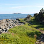
First view of Kearney’s Beach from the trail.
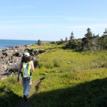
The trail winds through a wet patch approaching Kearney’s Beach.
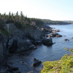
The view from the eroding trail above Deep Cove. A more secure loop around Deep Cove is available.
Hikers should be careful approaching the erosion at the edge of Tinkers Point.
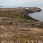
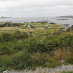
The meadow at Tinker’s Point.
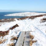
The trail marker opposite the boardwalk viewpoint at Kearney’s Beach.
First view of Kearney’s Beach from the trail.
The trail winds through a wet patch approaching Kearney’s Beach.
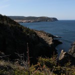
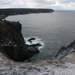
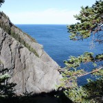
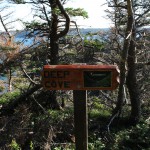
Deep Cove from Cape Canine.
Cape Canine provides a view back at Deep Cove.
Another view of Deep Cove from the other side.
The view from the eroding trail above Deep Cove. A more secure loop around Deep Cove is available.
The trail follows the coast through patchy woods along a property marked by wooden fence.
The trail reaches the rocky coast.
After narrowing from the cart path, the trail descends and crosses a river over a stone bridge.
A beautiful sunset over Maddox Cove.
One final boardwalk on the way into Maddox Cove.
A bridge across one of the gulches approaching Maddox Cove.
The sun sets on the trail behind us.
The first view of Petty Harbour in the distance.
The interesting trail passes close to a gorge.
I’m thinking this must be First Stairs.
It’s hard to make out, but yes, this is the trail down over Second Stairs.
The tiny waterfall at the top of Second Stairs.
The trail leaving Herring Cove passes close to the edge.
Herring Cove, before heading inland a bit.
The setting sun lit the trail beautifully.
Island Cove. The trail passes close to the edge!
A nice rock bridge over one of the small rivers along the trail.
Hiking over the last of the erratic field.
One of the three large erratics at the Flats.
Looking out the rocky shore toward Herring Cove.
Think this is Killickstone Cove. The easily accessible erratics in the river leading down to this cove were apparently used as anchors.
A look back at the erratic field beyond Staffordside.
Cronnick’s Cove, same caveat, Apparently fishermen would come into these tiny coves to eat their lunches.
Howlett’s Cove, again, depending on my map reading.
Dollar Cove, if my map-reading skills are worth anything.
These rock paths come in handy when the area is wet.
Crossing the river at Staffordside.
A pitcher plant in the wetland around Staffordside.
The path to the boardwalk which leads to Staffordside, an abandoned settlement.
Looking down on Staffordside from the North Head trail, aside a rather large erratic.
The trail to North Head.
At the Basket a side trail to North Head begins. We went partway out.
The “Empty Basket”, a beautiful cove.
Tourists aboard this tour boat were treated to a spectacular show put on by a pod of feeding humpbacks who were splashing and slapping the water!
A view of Cape Spear with a tour boat steaming by.
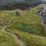
The trail winds out over windswept barrens.
This mudhole is quite deep, as the white dog in the background can attest 🙂
The trail starts through a small patch of woods over some boardwalk.
The coast laid out before us to be walked, North Head in the distance!
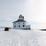
The older, original lighthouse, restored and open to the public for tours.
The first lighthouse, automated if I recall correctly.
The exit to the bunker and the gun emplacement.
The entrance to the bunker at Cape Spear.
The portion of the trail from Cape Bay to the Bunker skirts the rocky coastline.
The sun sets on our destination!
This lane leads to the Mobile trailhead. Parking is at Mobile Central High.
The Mobile trailhead!
The remains of an unknown, 75 cm shark.
The trail crosses over some rocks at Mobile Beach.
The steps onto Mobile Beach.
A brave little bunny checked us out!
The sign at the Mobile side of Nolan’s Meadow.
A tiny rainbow overhead as we exit Nolan’s Meadow.
A trail marker clearly indicates the trail at a sharp turn.
Woods approaching Nolan’s Meadow.
Still unhappy. Couple of quick snaps and we backed off.
He was none too pleased to see us! Taken from the Herring Cove path.
The side trail to the Herring Cove lookout.
A small, agile whale off Mobile Point. A minke, perhaps?
Mobile Point from Little Bald Head.
A short side trail at Little Bald Head offers some spectacular views…
The trail leading up from Back of the Point.
Breaking Beach, a spectacular stretch of cobblestone beach. Can you see the tent in the meadow? 🙂
An interesting wooden bridge at the entrance to the meadow above Breaking Beach.
The trail overlooking Breaking Beach.
A windswept tree along the rocky shore near Lower Long Rock Cove.
The picturesque river and bridge at Camel Beach.
Camel Beach from the North.
Plank walkway crossing a wet section.
The sign as seen from the Motion approach.
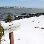
Twelve O’Clock Beach from the trail above.
Rocky outcroppings and cobblestone beaches.
Heather starts on the grassy trail near Pounce Hollow.
The trail starts on a cobblestone beach.
Gerry and Friends Slowly but Surely Hike the East Coast Trail (and occasionally elsewhere)