Category Archives: East Coast Trail

Saturday Snowshoe at Blackhead Path!

Folks, yesterday was the first day that it wasn’t raining or snowing for almost a week, and it was a Saturday, perfect! Packed up the snowshoes and headed out to trek out and back over the Blackhead Path section of the East Coast Trail. The weather was fantastic, the trail was easy to follow except on the Blackhead (the community) side of the hike up to Blackhead (the bluff), where it was easy to lose but easy to pick back up.

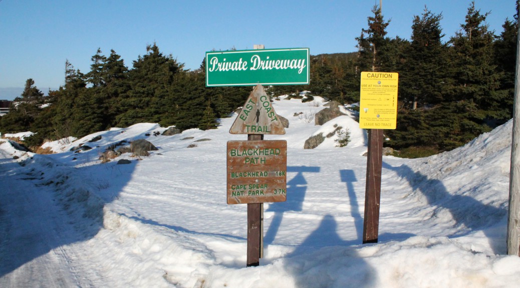
I started in the afternoon, took a few snaps of the slob ice in the bottom of Blackhead Bay, walked just past the end of the private property before which the trail begins, and veered off course. For some reason, a rocky patch of the trail didn’t look like the right way, despite that I knew I hadn’t passed certain key points, including a patch I knew would be wet. I decided I’d follow another path that was combination snowmobile and snowshoe, it headed in the right direction after all. After some adventures which had me ankle deep in a river (saved by the Scarpas!), I rejoined the trail and managed to stick to it for the most part as I made my way up to Blackhead. I have a feeling the trail will be easier to follow in a few days since we’re looking at more rain and warm weather which should melt the snow currently covering the hill. That said, for the time being, it’d help to be familiar with the trail. It’s not likely you’d get lost, but keep an eye out for those trail marking poles on your way up the hill.

The trail was well defined and easy to follow from the top of Blackhead on for the most part. I passed a couple of hikers out enjoying the fine weather, coming from the other direction. Climbing down the other side of Blackhead through the woods was incredible. A grouse paid me a visit. Breaking out of the woods, there was a little bit of a chilly breeze as I walked the last few hundred metres to the trailhead at the edge of the Cape Spear Park property, but for the most part, I was toasty warm. I had my jacket packed and my hat and mitts off for a lot of the walk…

…which led to an unfortunate incident. I lost a black claw-style Swamy mitt somewhere between the other side of Blackhead and the viewpoint near the Cape Spear trailhead. I know, it’s only a glove, but I like these mitts, and I’d love to get it back if anyone spots it.

Anyhow, here are some pics I took! I’ll post these on the Blackhead Path page as well!

A Late Winter Hike at Cape Spear!

I’ve been on mid-term break all week and itching to get out for a little hike, but the weather has been uncooperative: I’m not one for extreme cold weather, and with wind chills dipping into the -30C range, I was waiting it out. Friday started promising, warming but windy, and knowing that I’d only be out for a couple of hours, I waited for the later part of the afternoon, when the temperature got up to -4C. It was still pretty windy, but once I got into the shelter of the woods at the start of the Cape Spear Path, it was a wonderful snowshoe trip! My goal was Staffordside, or at least the branch that leads to the valley, but I left it too late, and given my lack of exercise this winter, it was probably for the best… snowshoeing is hard work at times! I turned around as the path climbs the ridge over Sharks Point at about the 4 km point (the parking lot where I started is about at the 1.1 kilometer point). 5 or 6 km in the bright sunshine through the snowy woods!

I saw a few interesting birds of prey including a snowy owl who I scared up from some rocks just past the lighthouse. I fumbled with the zoom lens with mittened hands and didn’t get it on in time to get a good shot of him. Afraid that’d happen again, I hiked out to my destination with the zoom attached and switched to the more landscape-friendly 18-55mm for the return trip. A pair of eagles flew overhead as I descended the hill to the parking lot: even without the zoom lens, they came close enough for me to get a couple of nice shots!

Pics below and in the Cape Spear Path gallery!

The Snowy Owl Invasion of 2013

Hi folks! I got a question about the pic of the Snowy Owl above, taken at Red Head on the Stiles Cove Path trail of the East Coast Trail. This was a late fall hike, snow was on the ground, as you can tell, and we came out of the woods to find a pair (male and female) of Snowy Owls. We stood back and took a few pictures as best we could (I had left my zoom lens at home so I did what I could with my 18-55mm), and the owls obliged us by flying close by a couple of times. We didn’t stick around for long, thinking they were probably stressed by our proximity, so we made a wide berth around them… a little too wide, because we ended up taking a community path away from Red Head and getting sidetracked by a half hour or so!

We had heard about the “Snowy Owl Invasion of 2013”, and this was our encounter with it! You can read more about the Snowy Owl Invasion at this link. Bruce Mactavish, the article’s author, is a local birdwatching expert.

The best of the pictures I took that day can be found here, on my Tumblr. Cheers!

Starting the Spring/Summer Hiking Plan!

Hi folks! I sent off my membership application for the International Appalachian Trail, Newfoundland and Labrador chapter today! Pretty exciting stuff. I’m looking forward to getting access to the maps and GPS tracks that come with membership. I’m still undecided as to which course to take for my “big” hike this spring/summer, but one or more of the trails along the IATNL route is a strong possibility… I was thinking that I might hike the Grand Codroy Way, Starlight Trail, and then take the IATNL long distance route to Stephenville, if such a thing is feasible… can’t wait to get the maps in hand and figure it out! Anyhow, that’d be about 200 km, so a week or two of solid hiking. It promises to be an incredible experience.

The other possibility I batted around is a through-hike of the East Coast Trail… it’s almost 100 km longer than the IATNL option, but I’d be home for at least one night when the trail passes through St. John’s… decisions!

Whichever “big” hike I take on, I’ll be doing my warmup hikes on the ECT… I have yet to do the Motion/Spout twosome (for shame!) so that’ll be very early in the season… first chance I get with camera-friendly weather!

All credit for the above image goes to the IATNL. You can see the full version on their webpage!

More new content: Stiles Cove Path page added!

Hi folks! So technically, we haven’t finished this trail. There’s a 6 km section in the middle of the trail that we haven’t done: both times we went out on the trail in the past year we were doing out-and-back hikes and so we didn’t cover great distances, and despite that it irritates me not to finish a trail, we didn’t ever make it back to clue it up before the snow fell. It’s on my list of trails to tackle as soon as the snow melts and we have the time to hike again.

That said, we managed to snap some spectacular pictures on the sections of the trail we have seen over the past couple of years, so head on over to the new Stiles Cove page to check them out!

Edited to add: a short page added for the Deadman’s Cove Path, with much more to come when we complete it!

Cobbler Path page added!

We’ve hiked this trail a couple of times over the past couple of years, but I wanted to put off constructing the page for it until I had some pictures to go with it. The pics I took in 2012 were deleted… I spent the summer of 2012 hiking, taking pictures almost every day for two months, and lost the lot aside from a few that made it online in my tumblr or the old version of the hiking page. Sad. Anyhow, we head out as far as Torbay Point pretty frequently since it’s close to home, so I’ve had plenty of opportunity to get replacement pics for this trail, at least.

Check out the Cobbler Path page!